The Foxearth and District Local History Society

Home

Miscellaneous old maps of the area

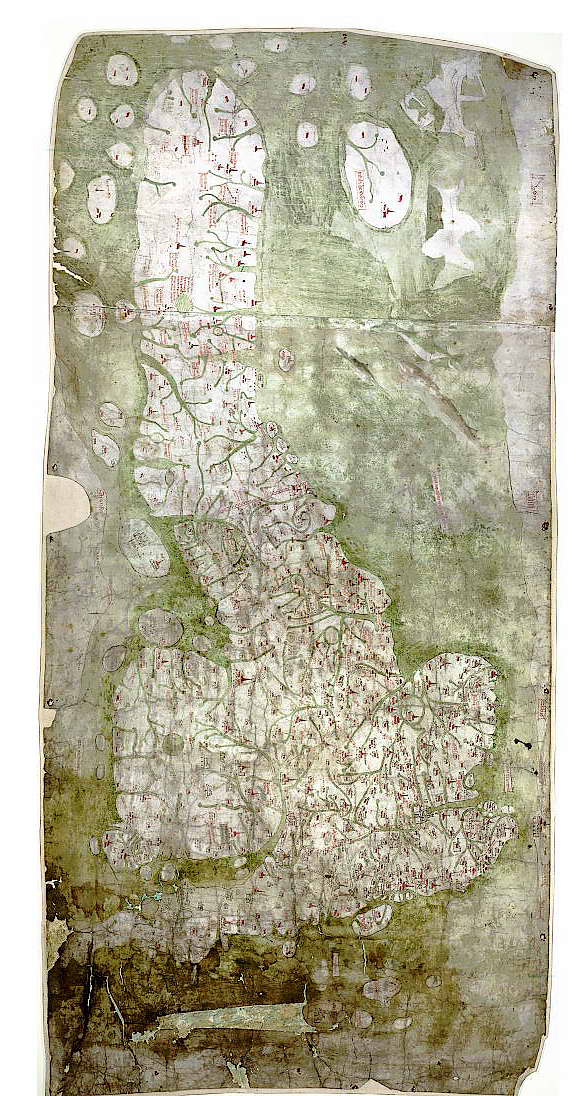
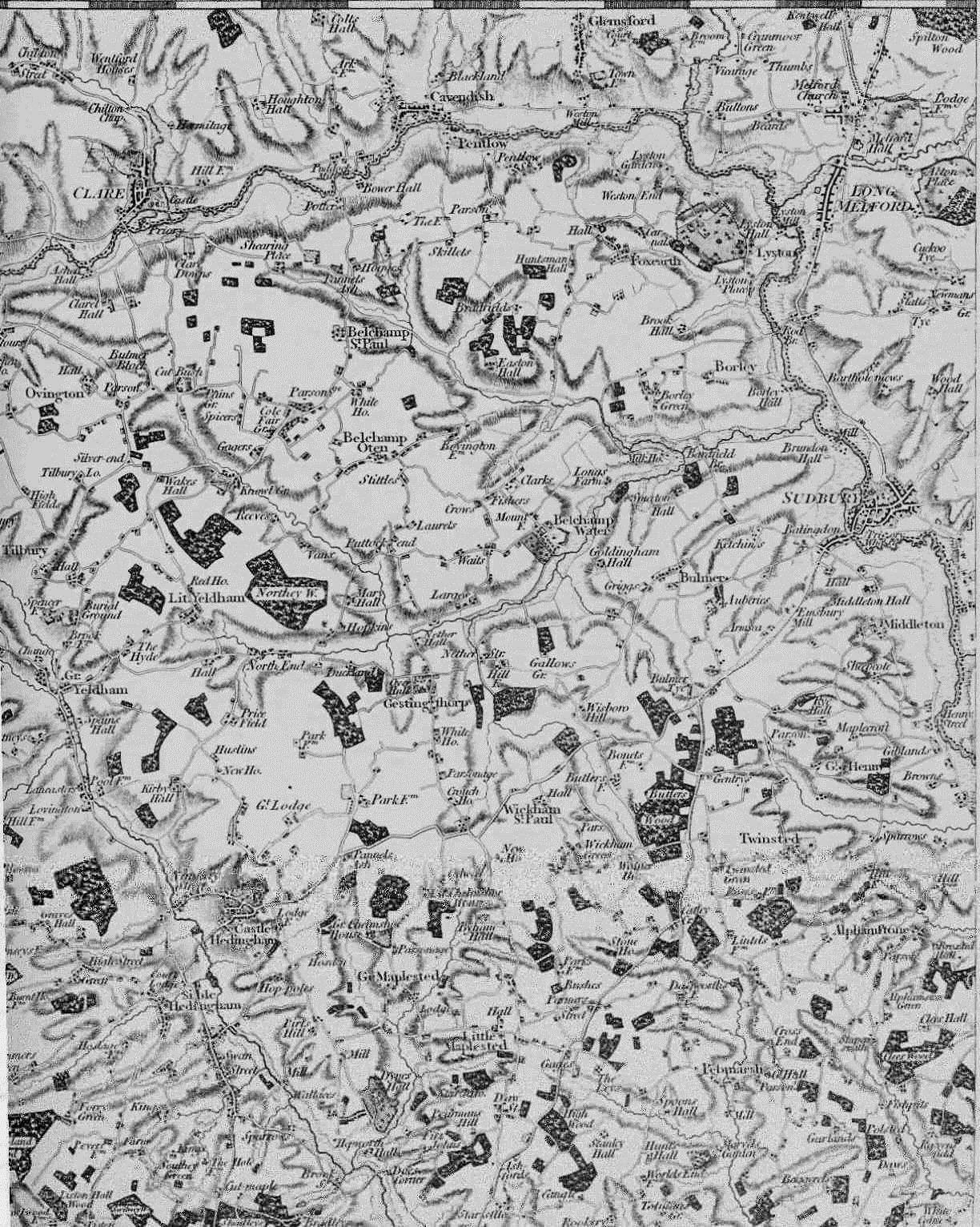
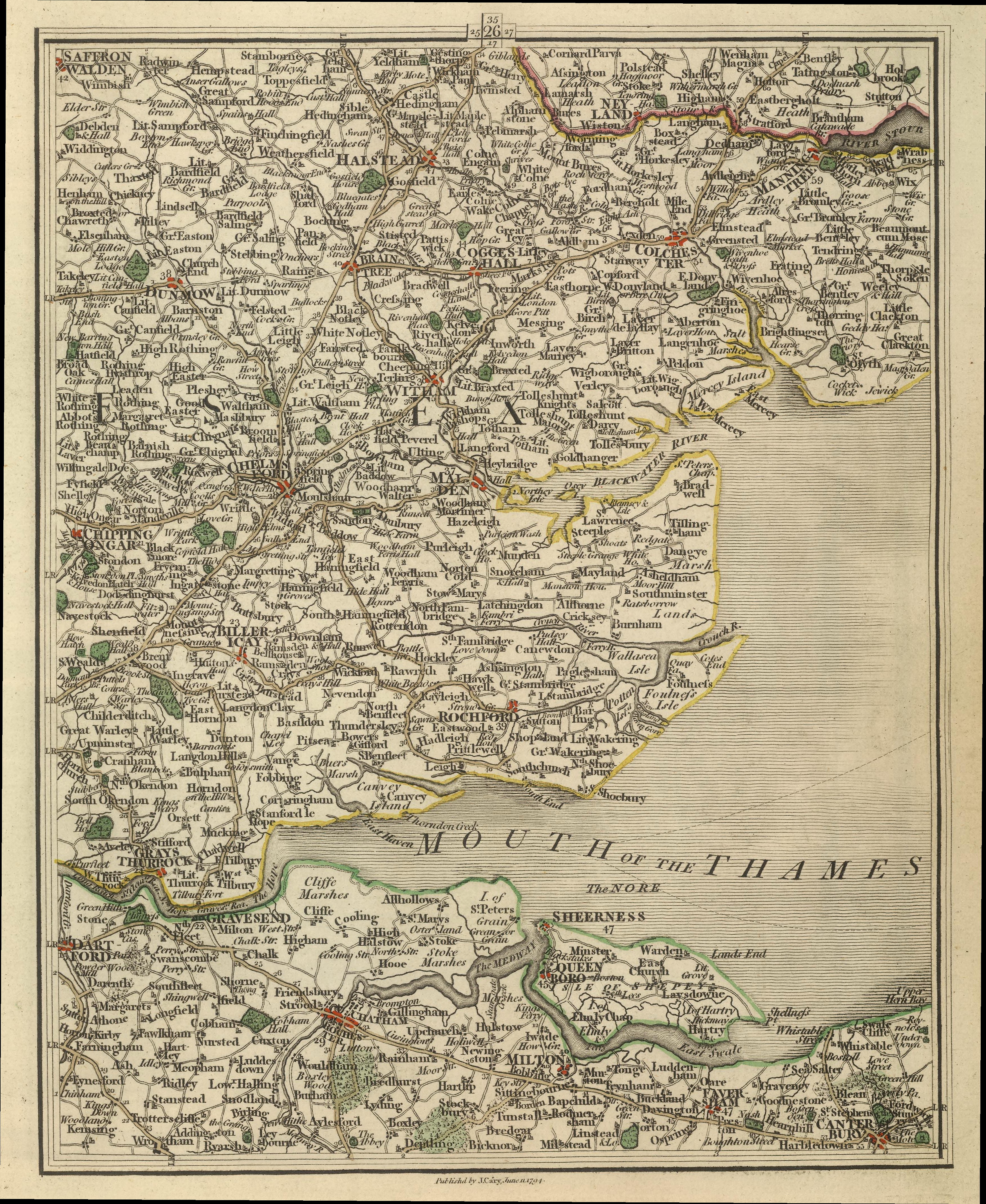
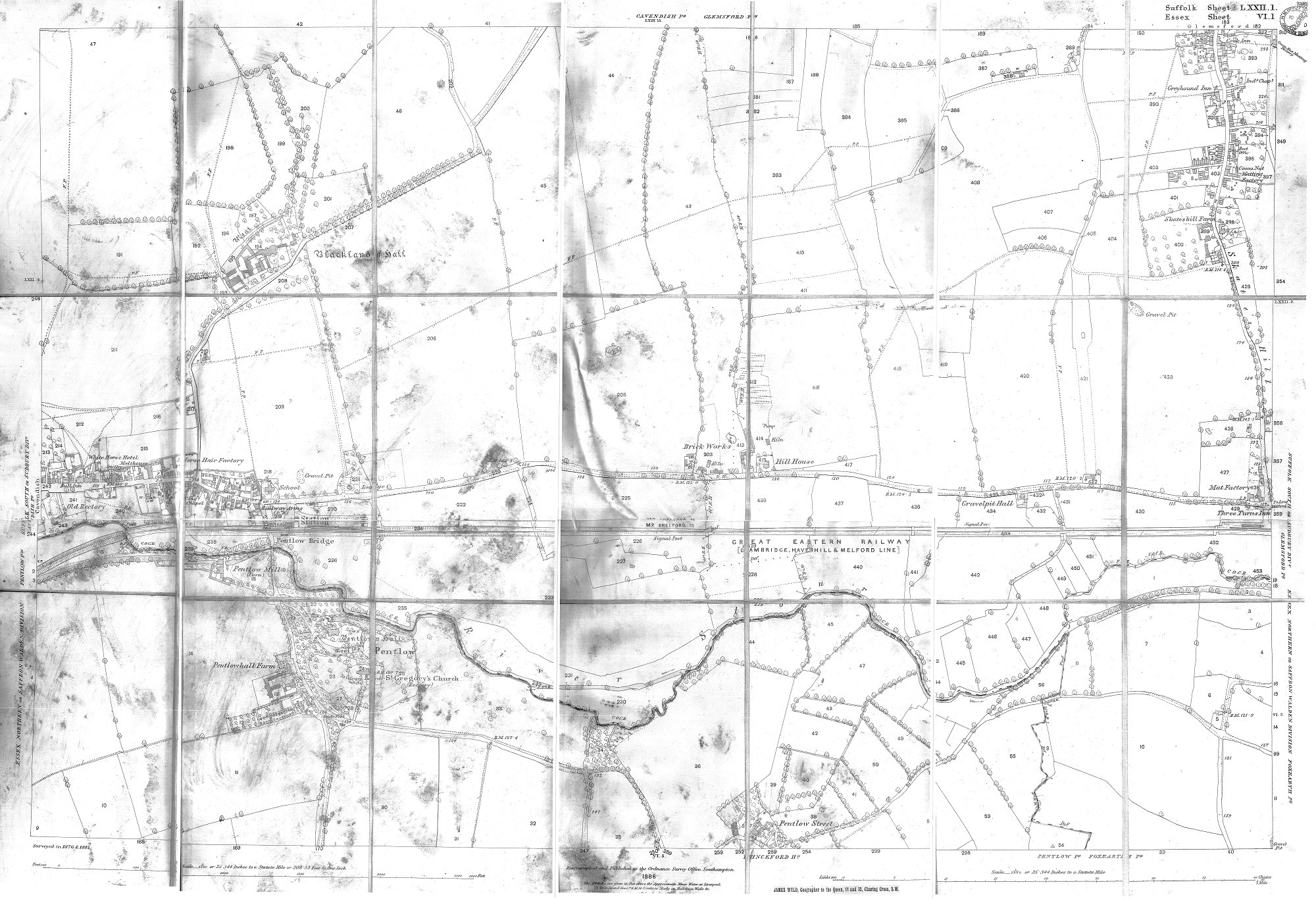
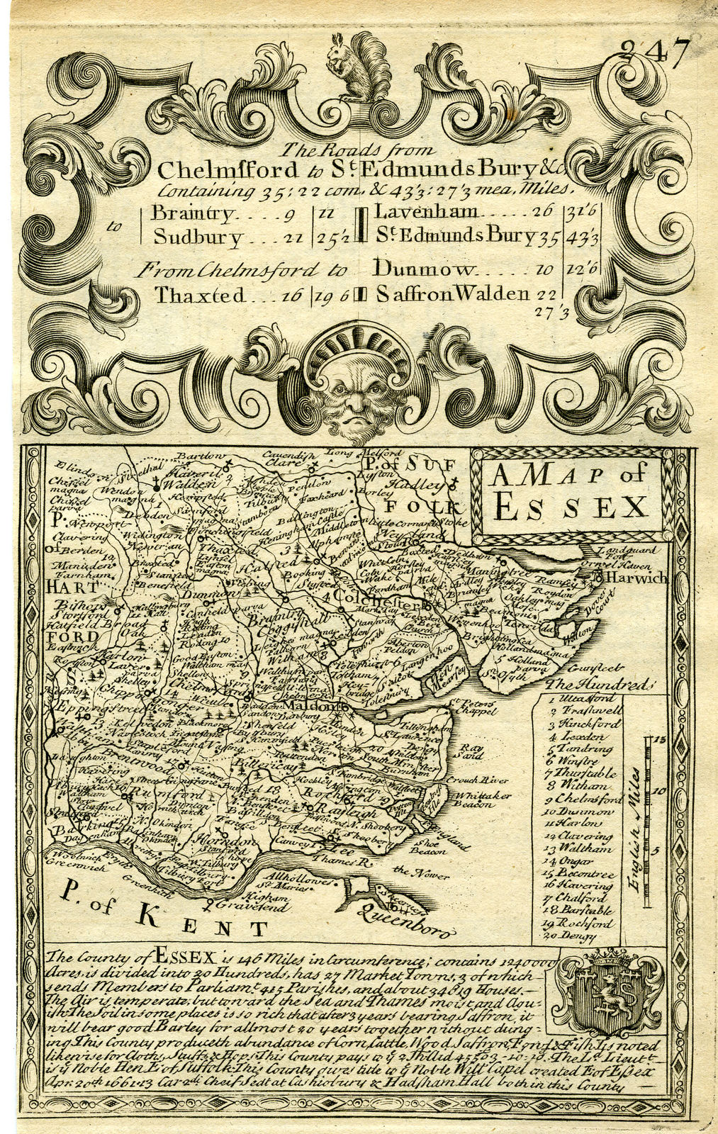
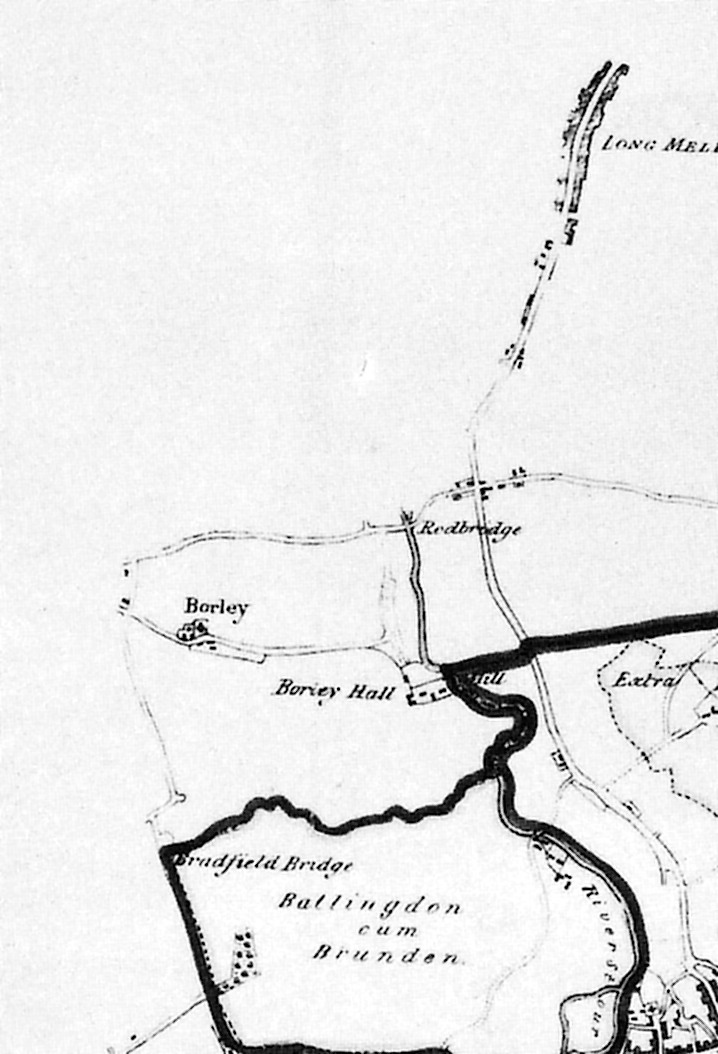
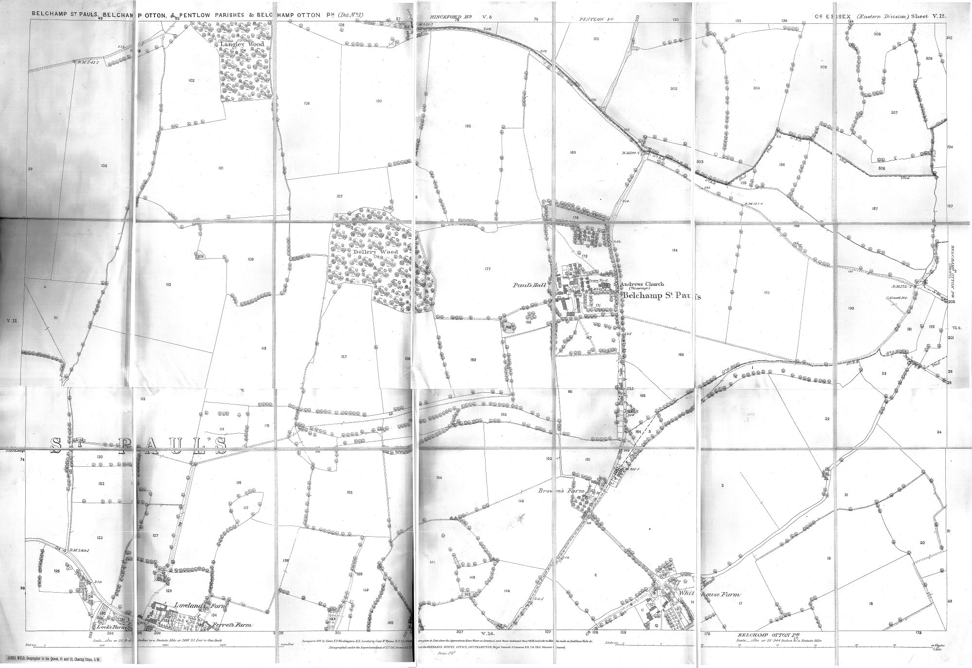
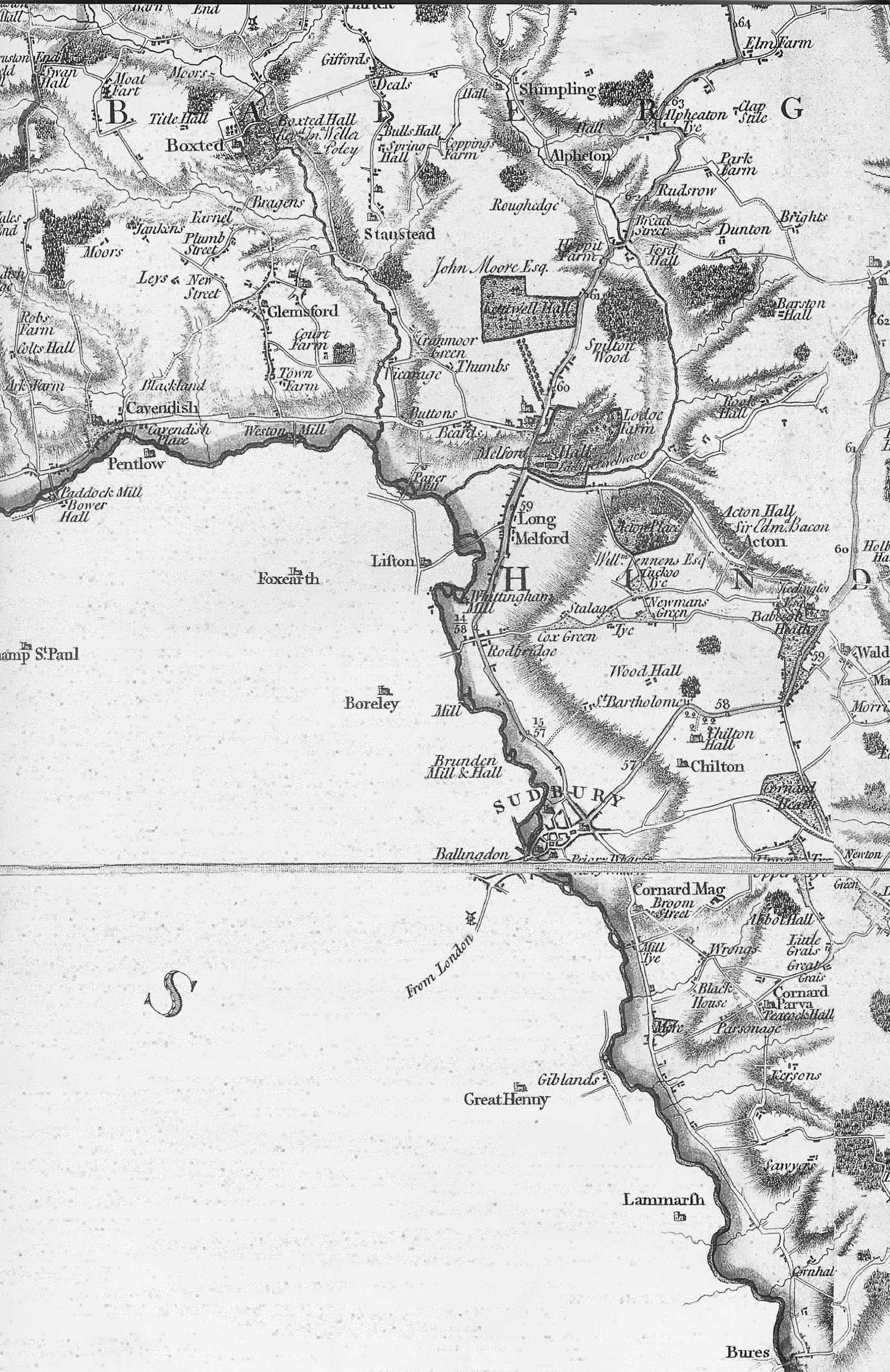
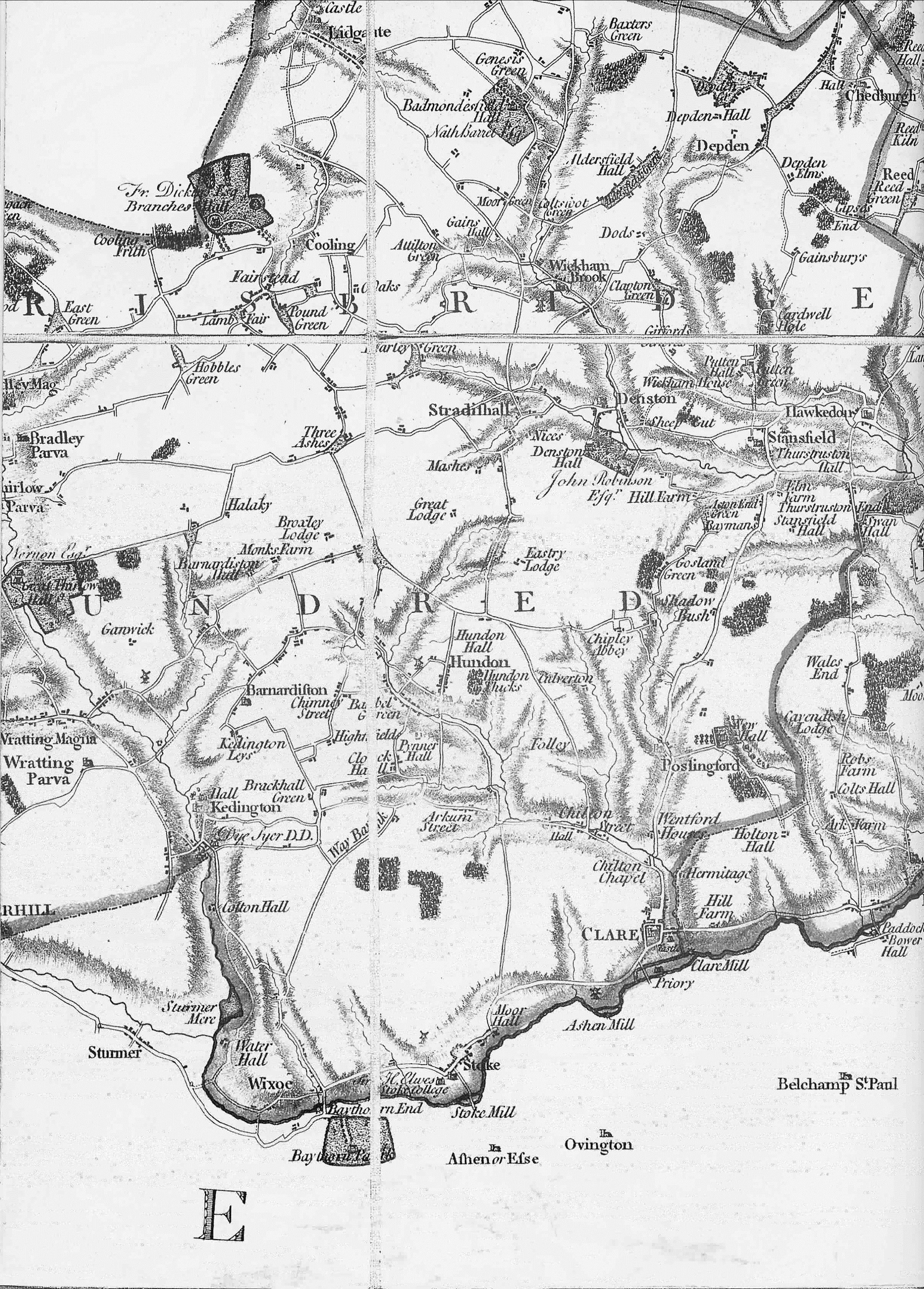
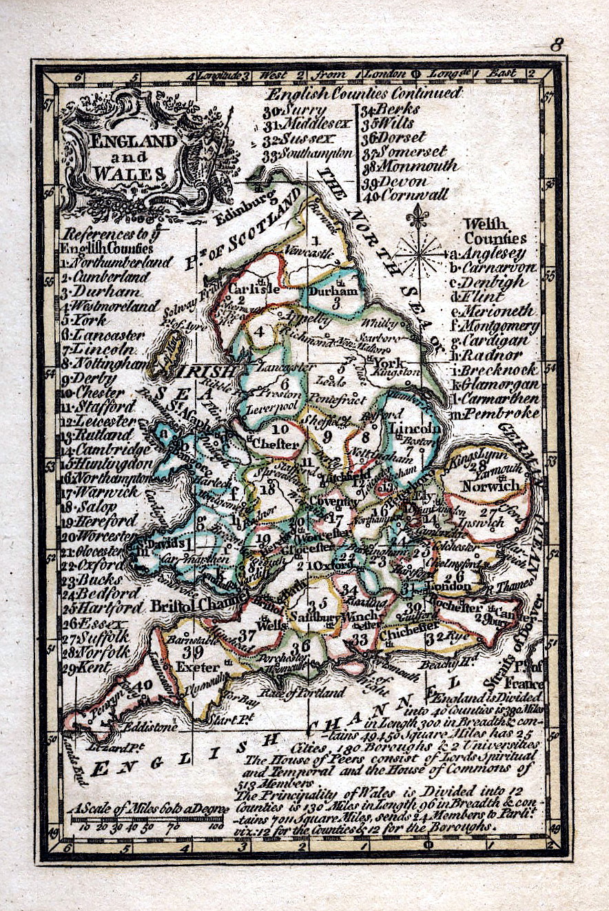
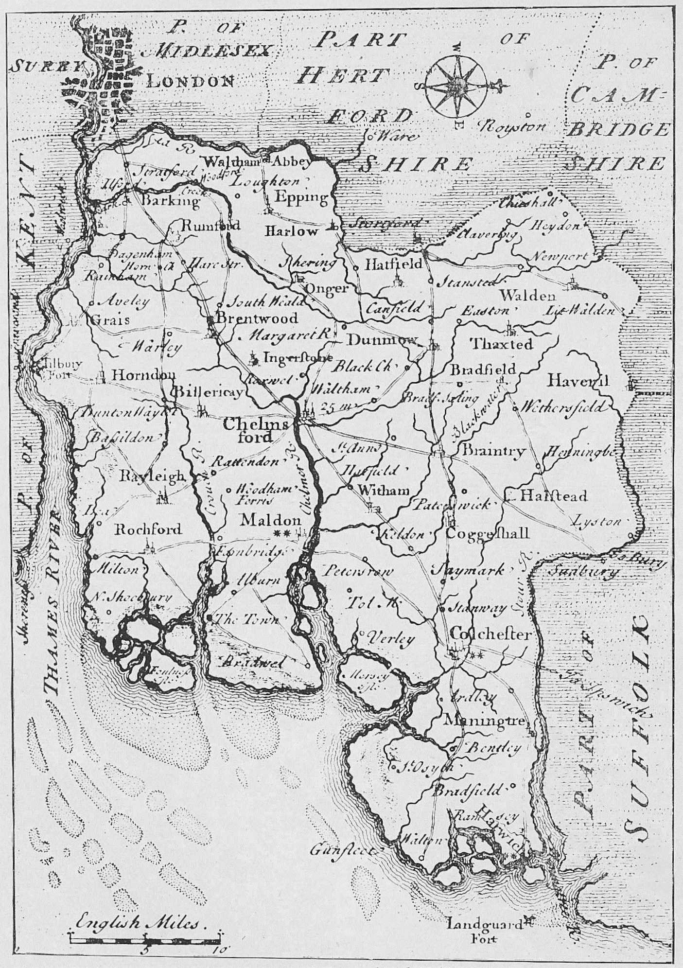
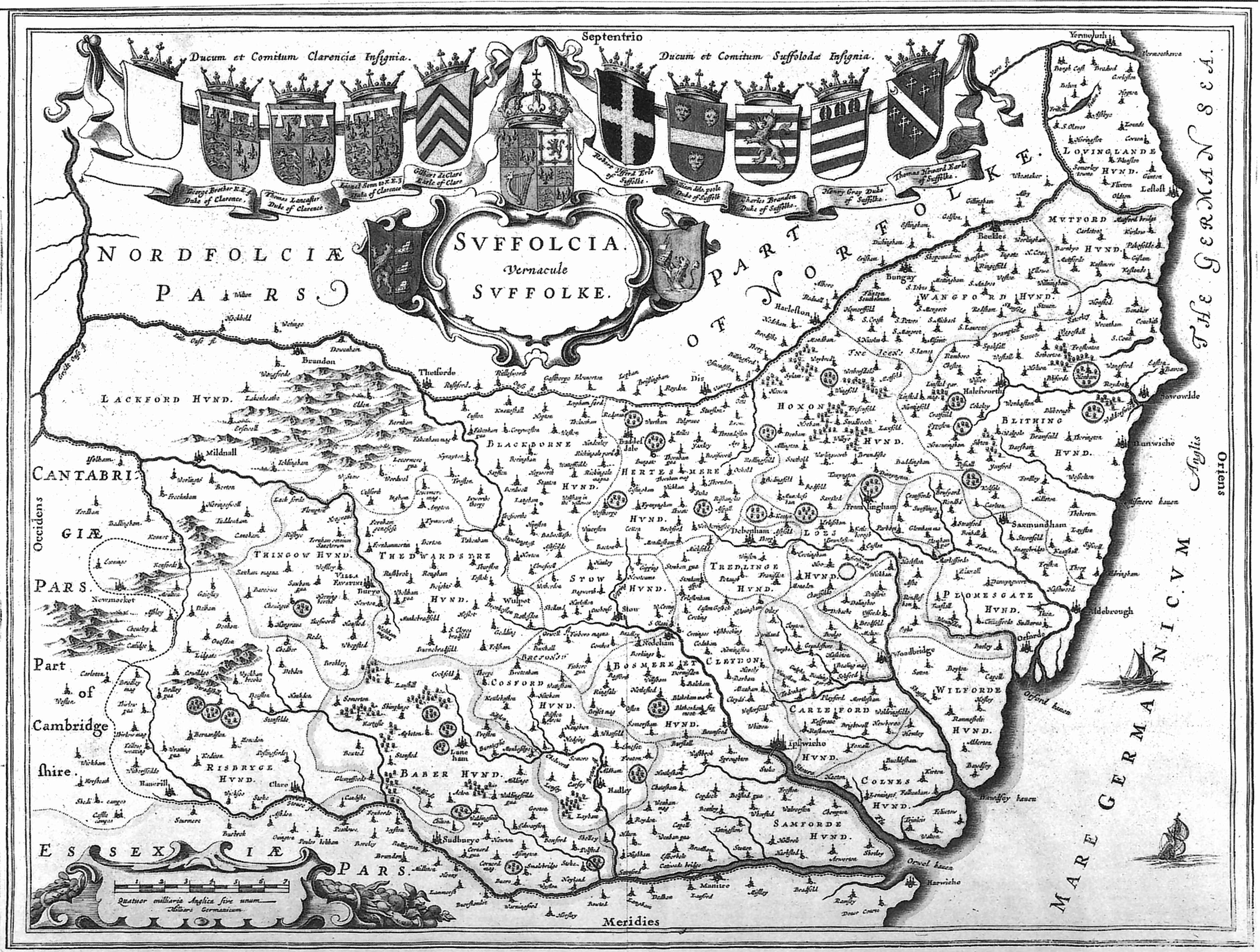
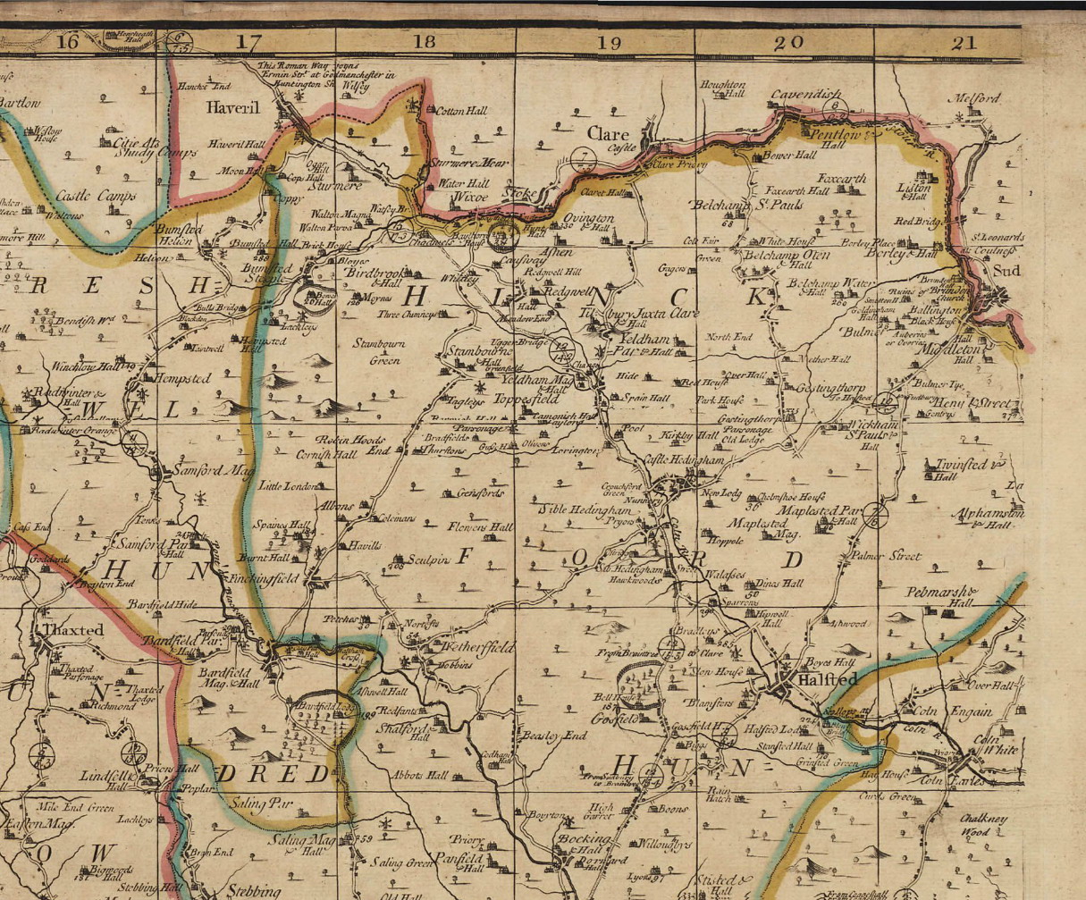
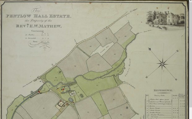
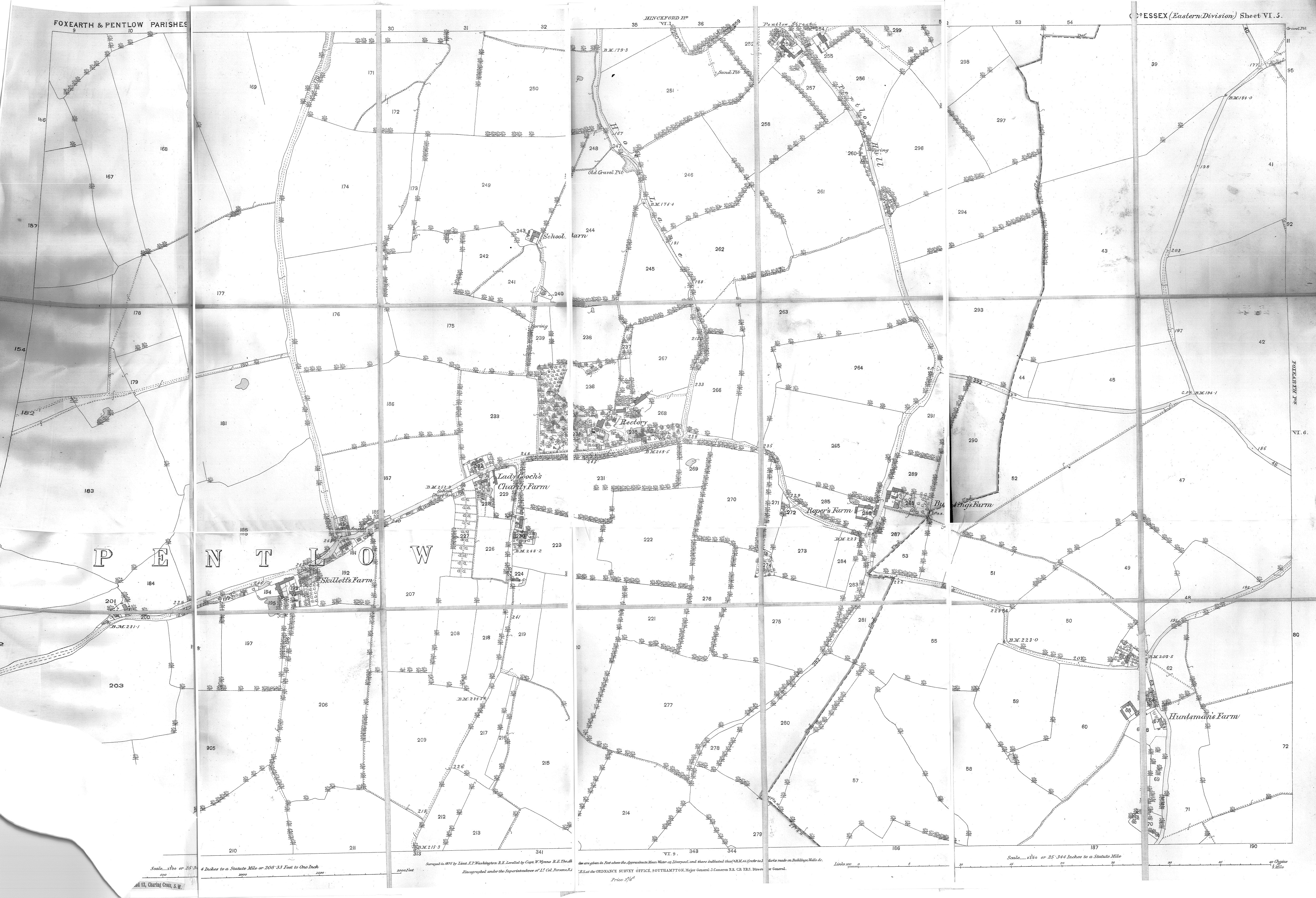
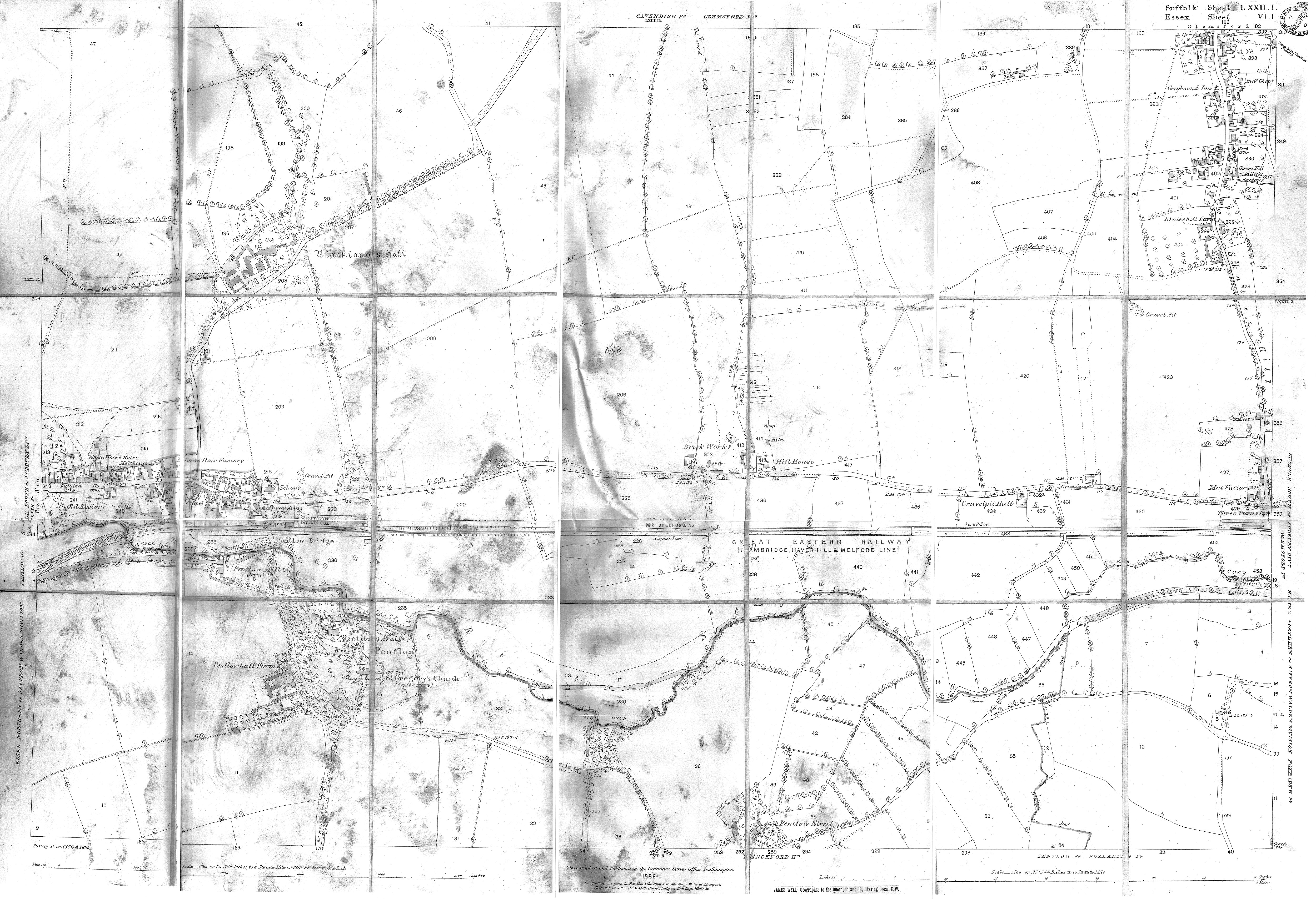
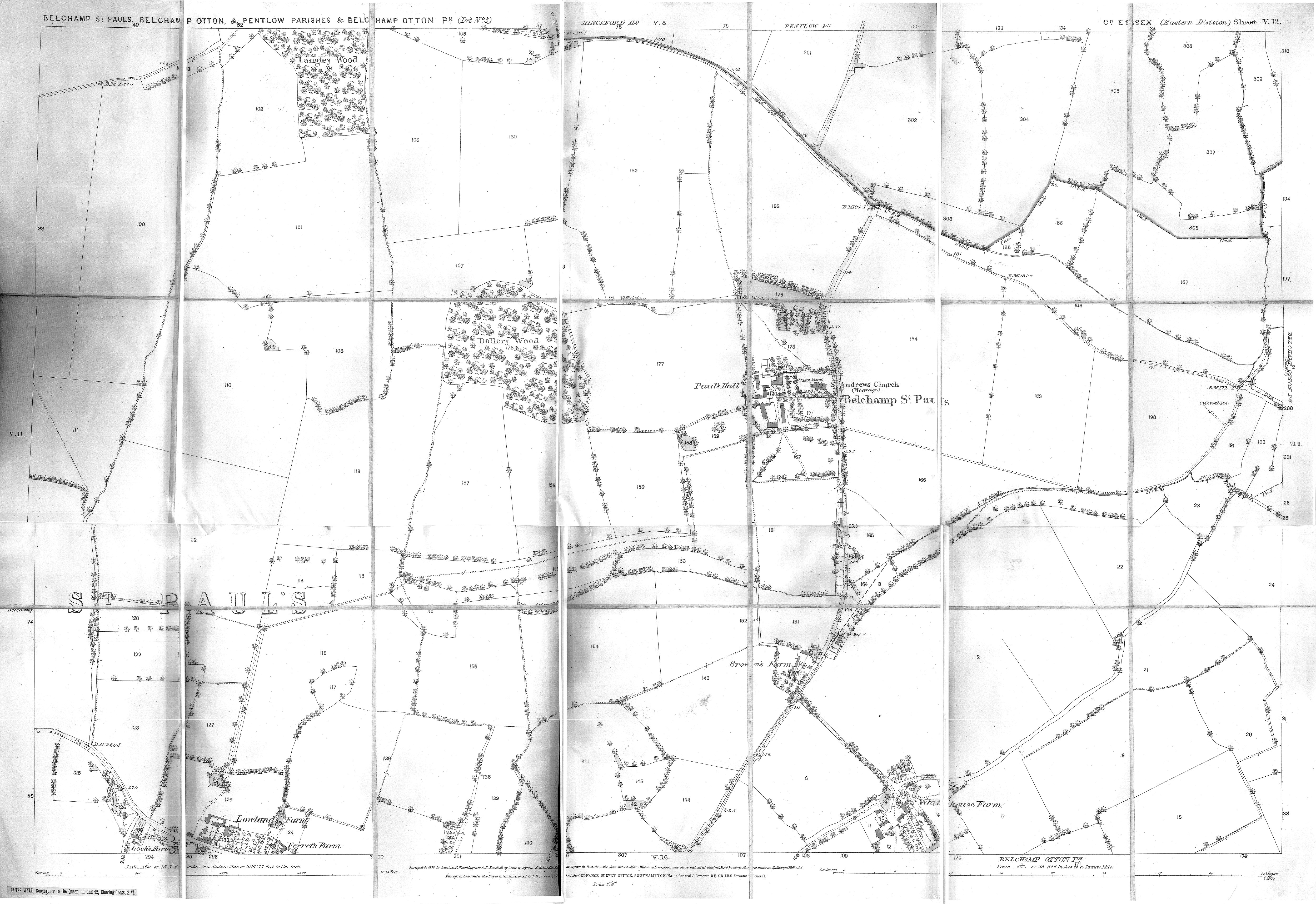
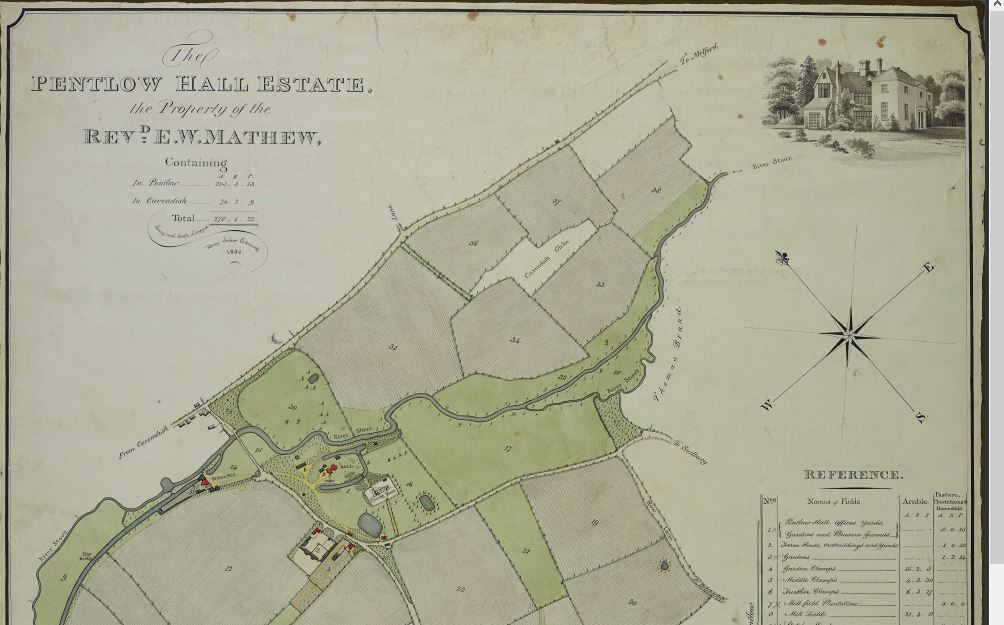
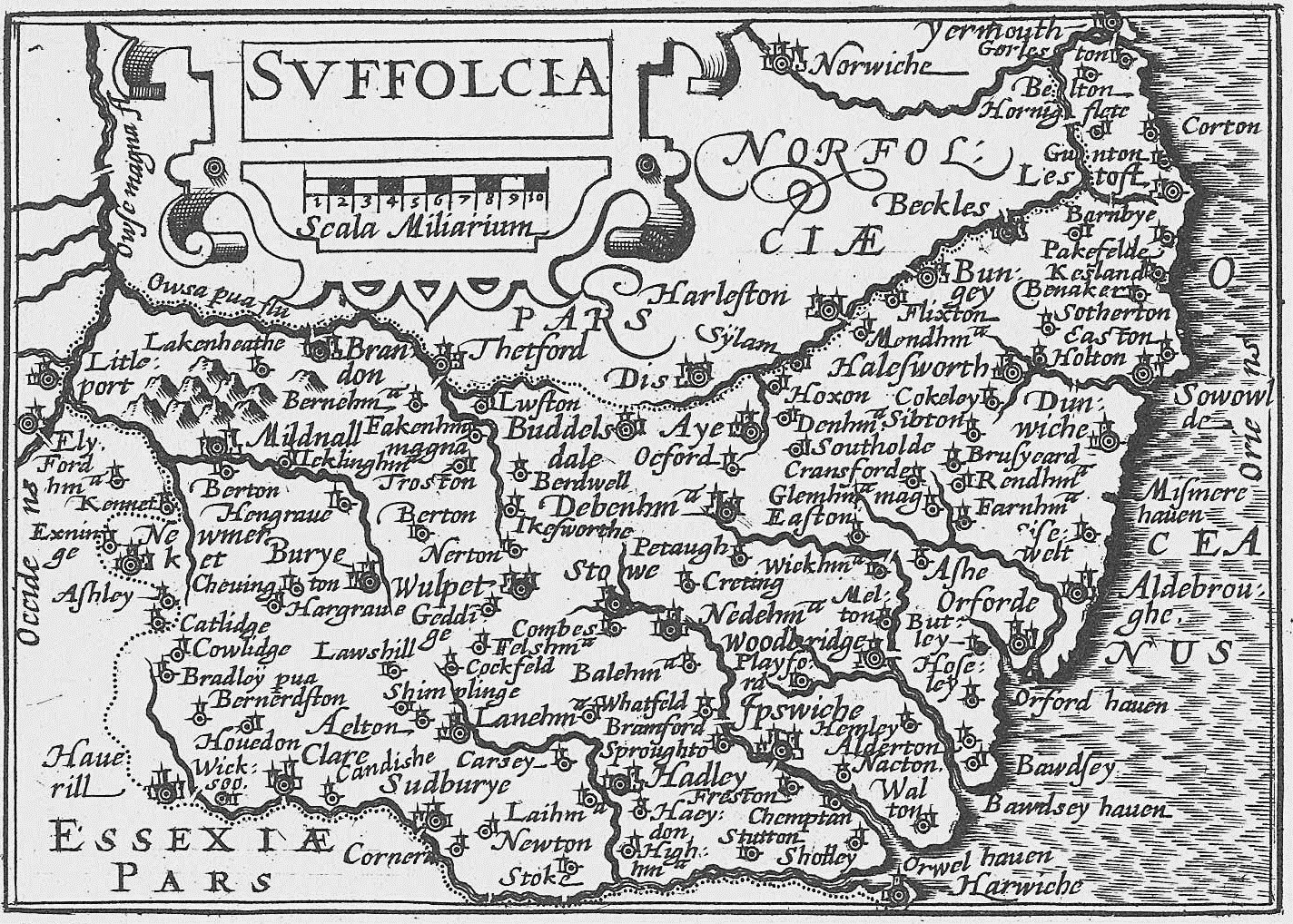
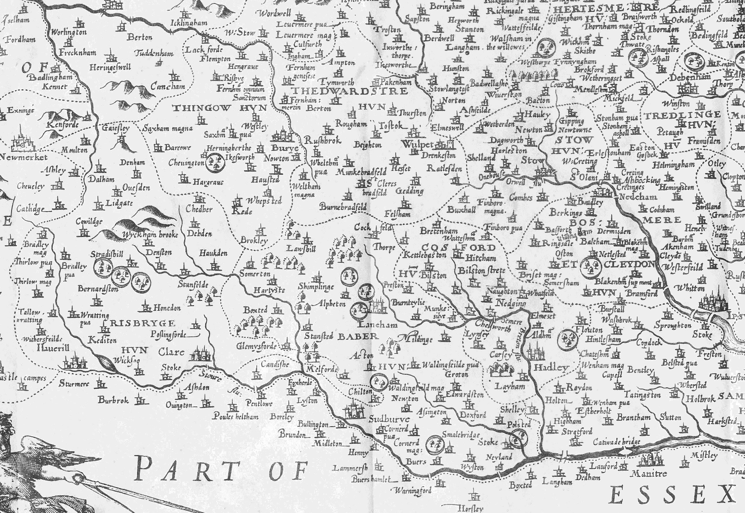
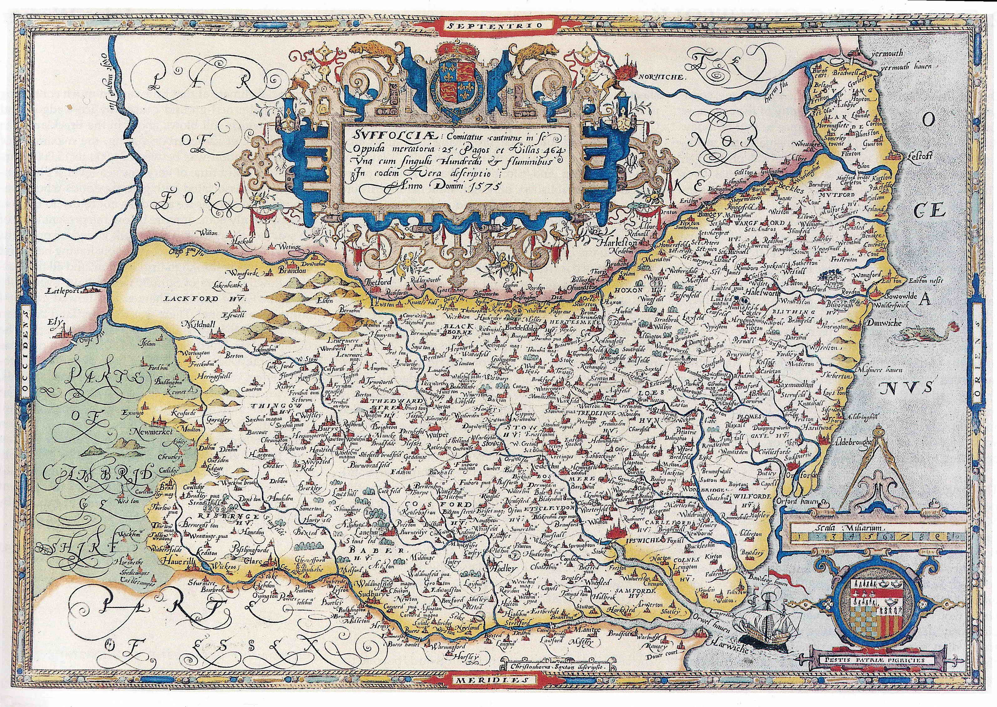
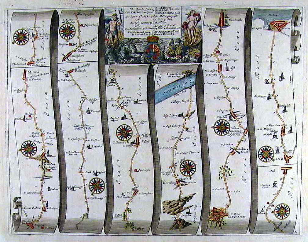
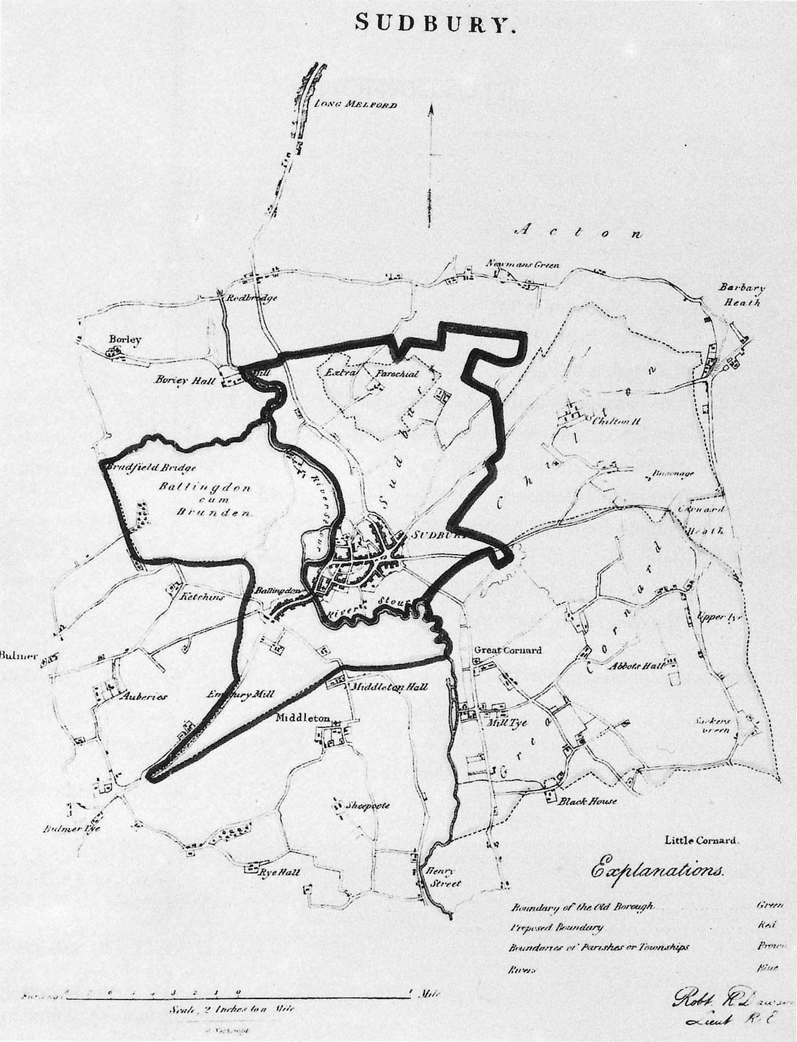
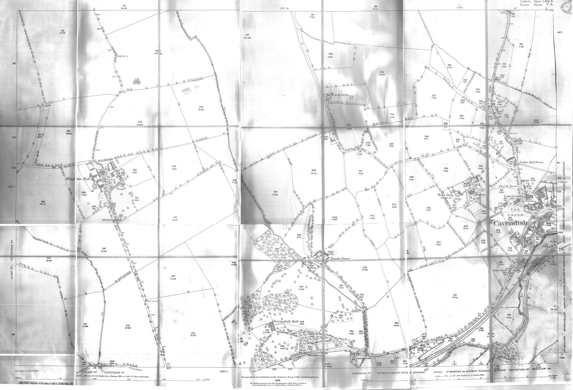
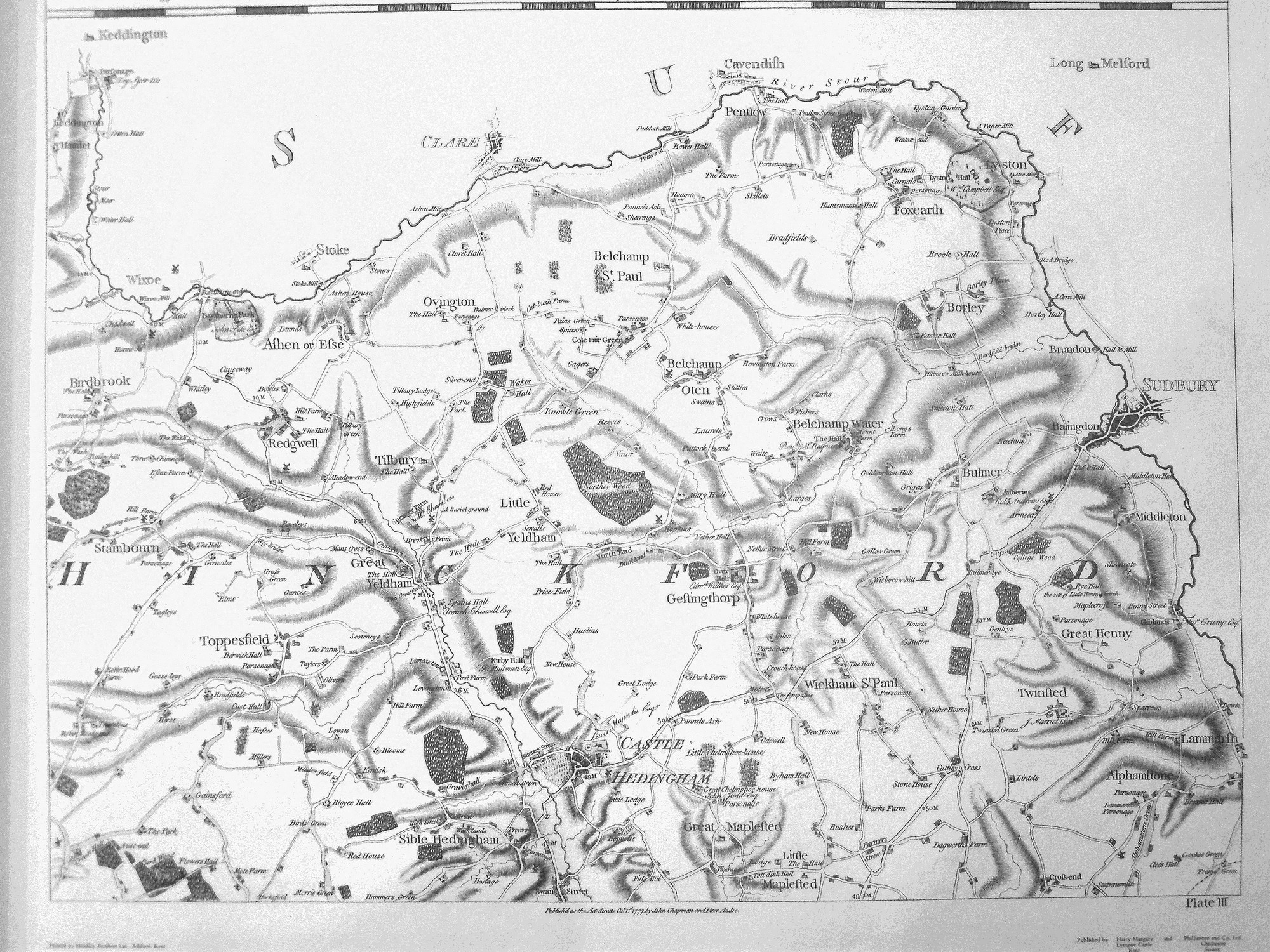
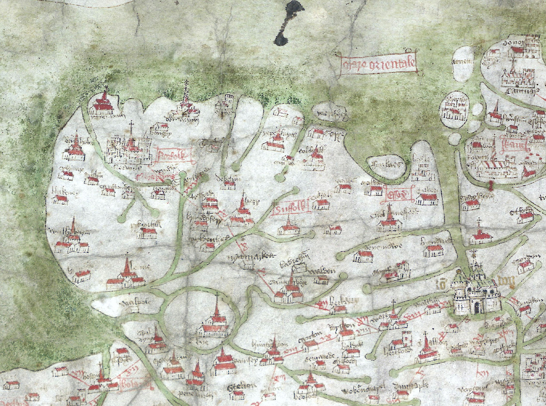
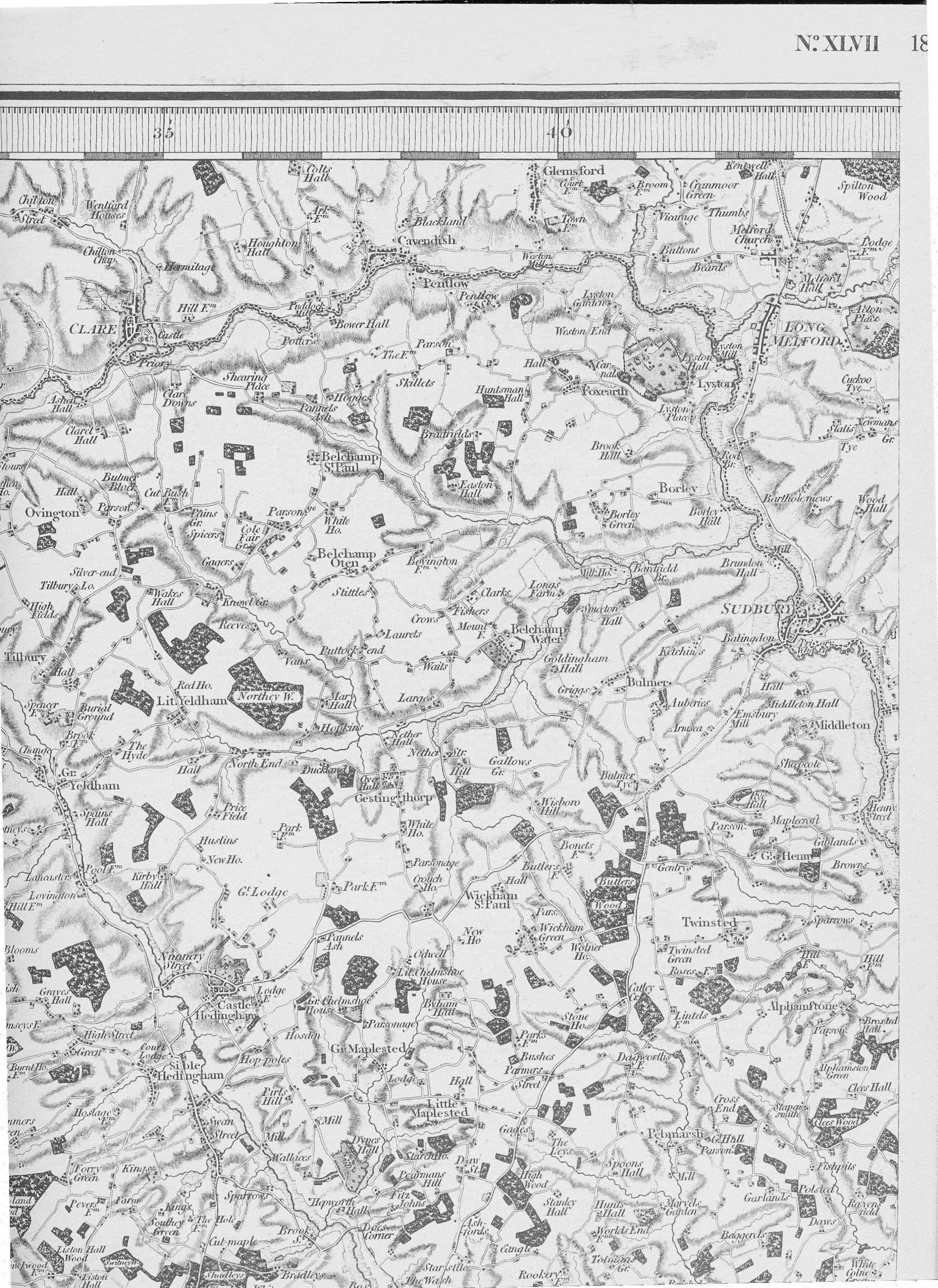
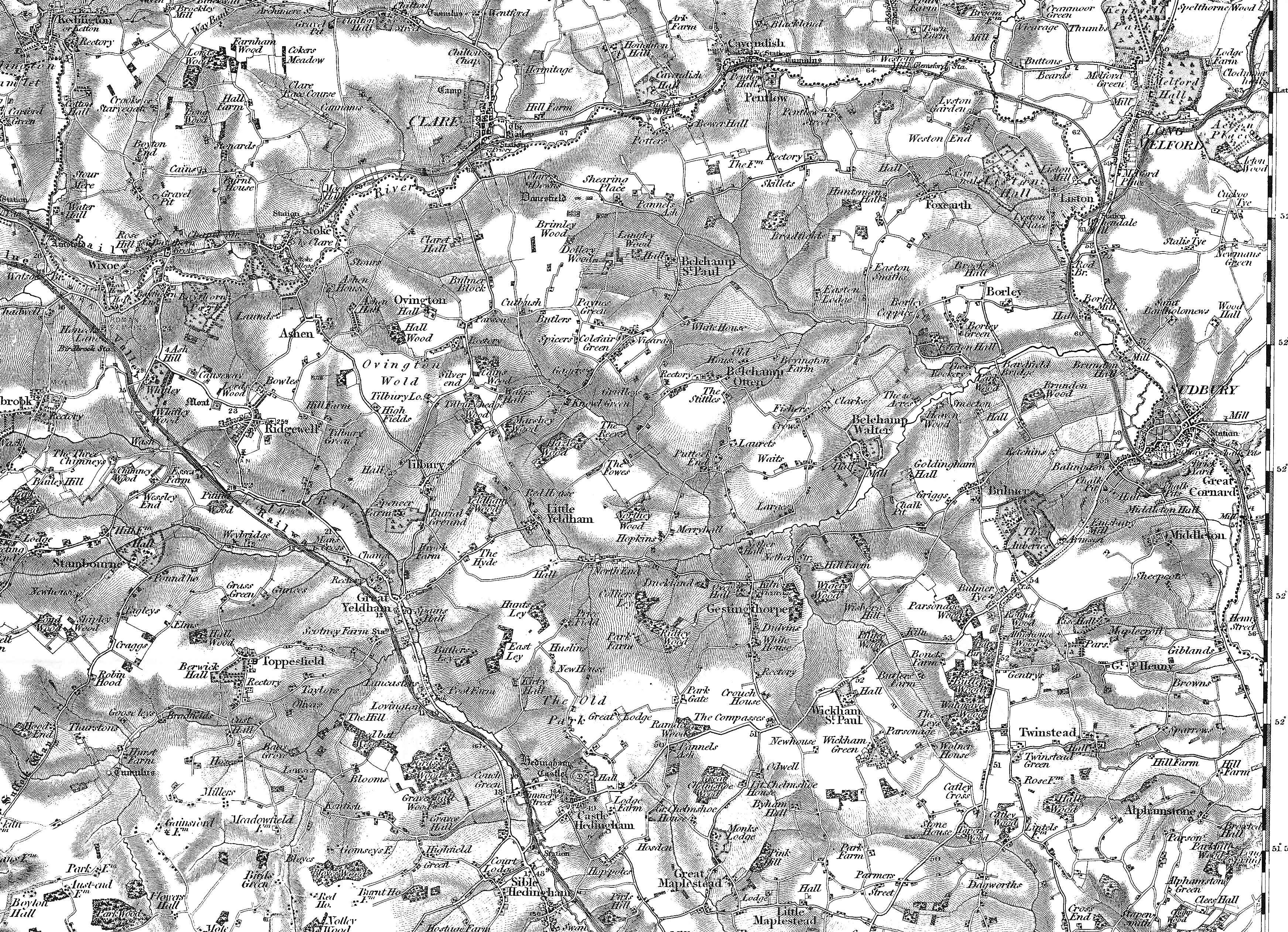
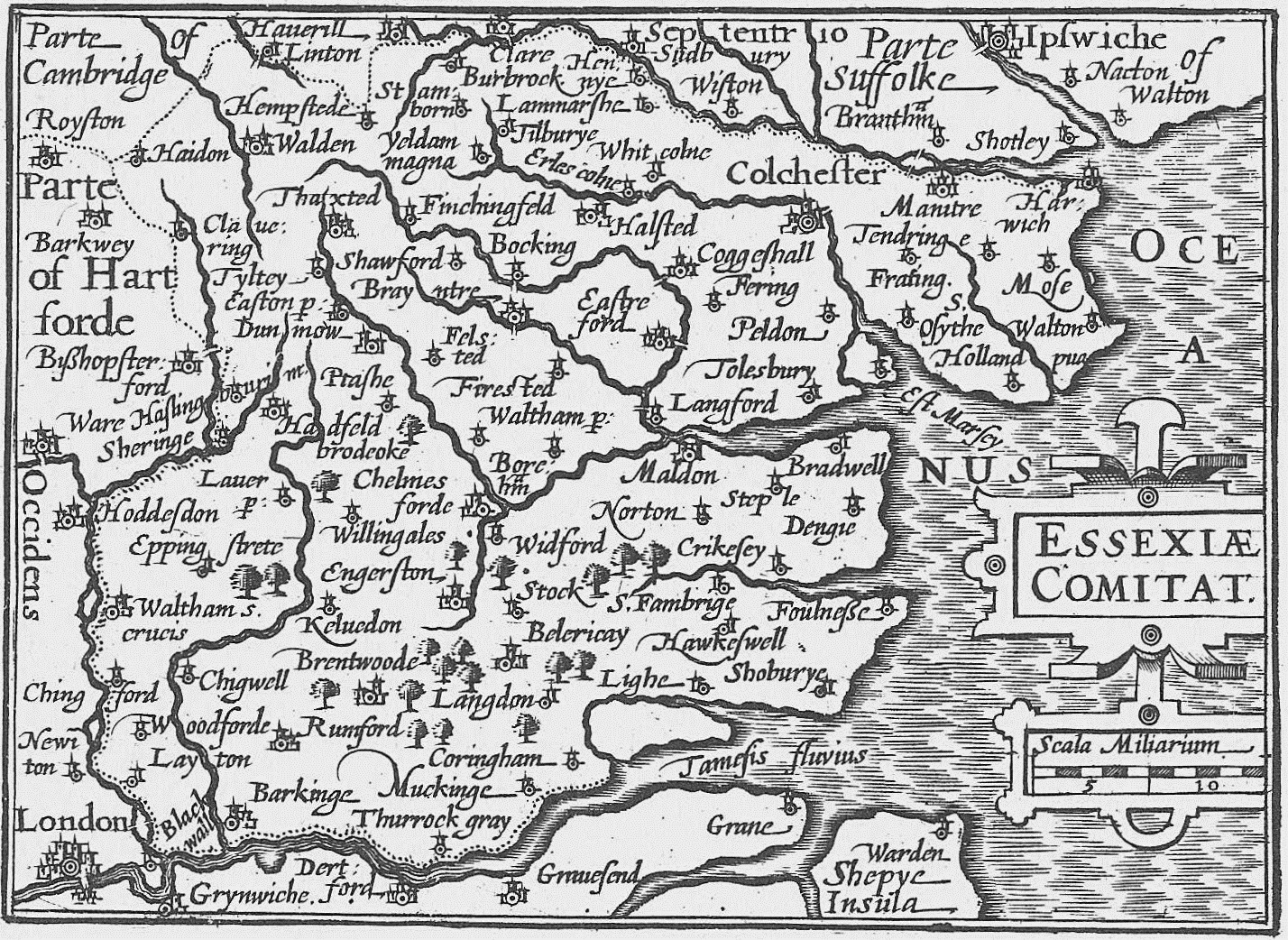
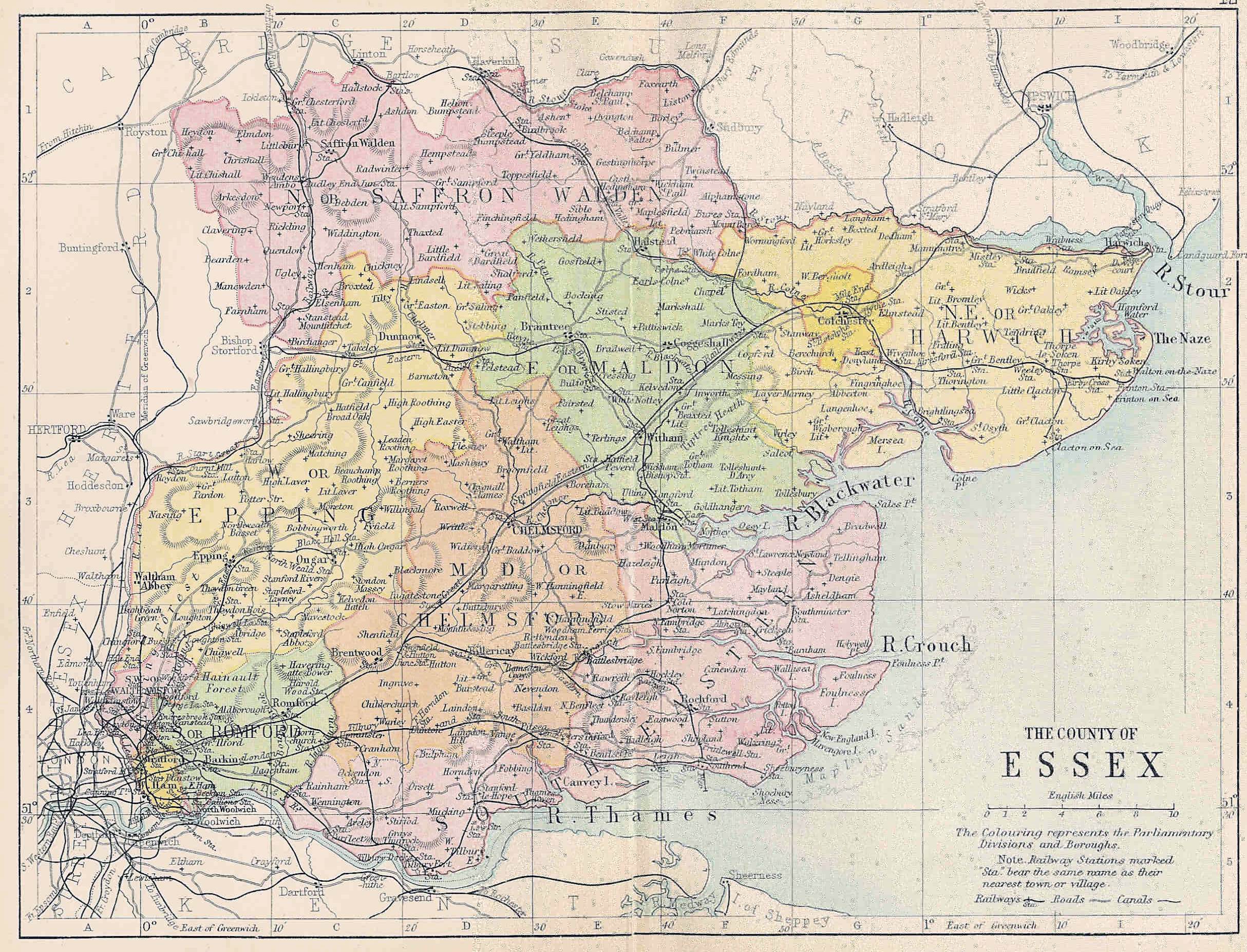
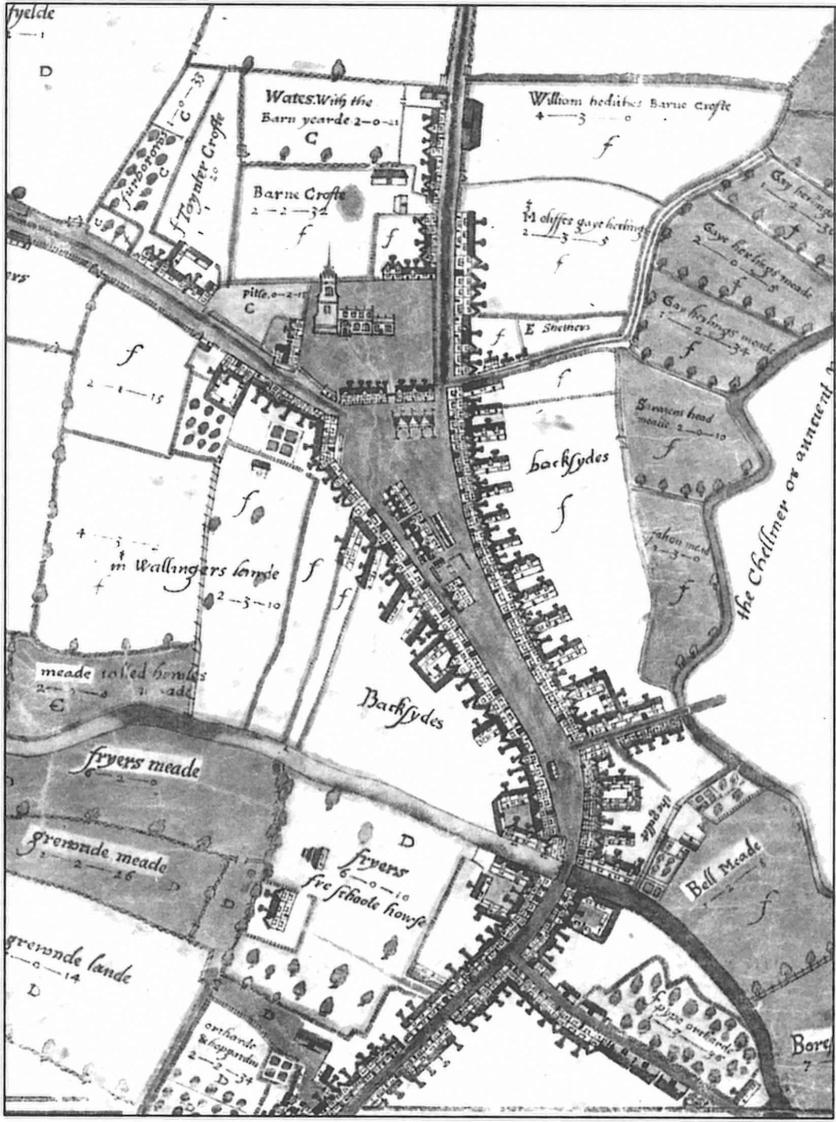
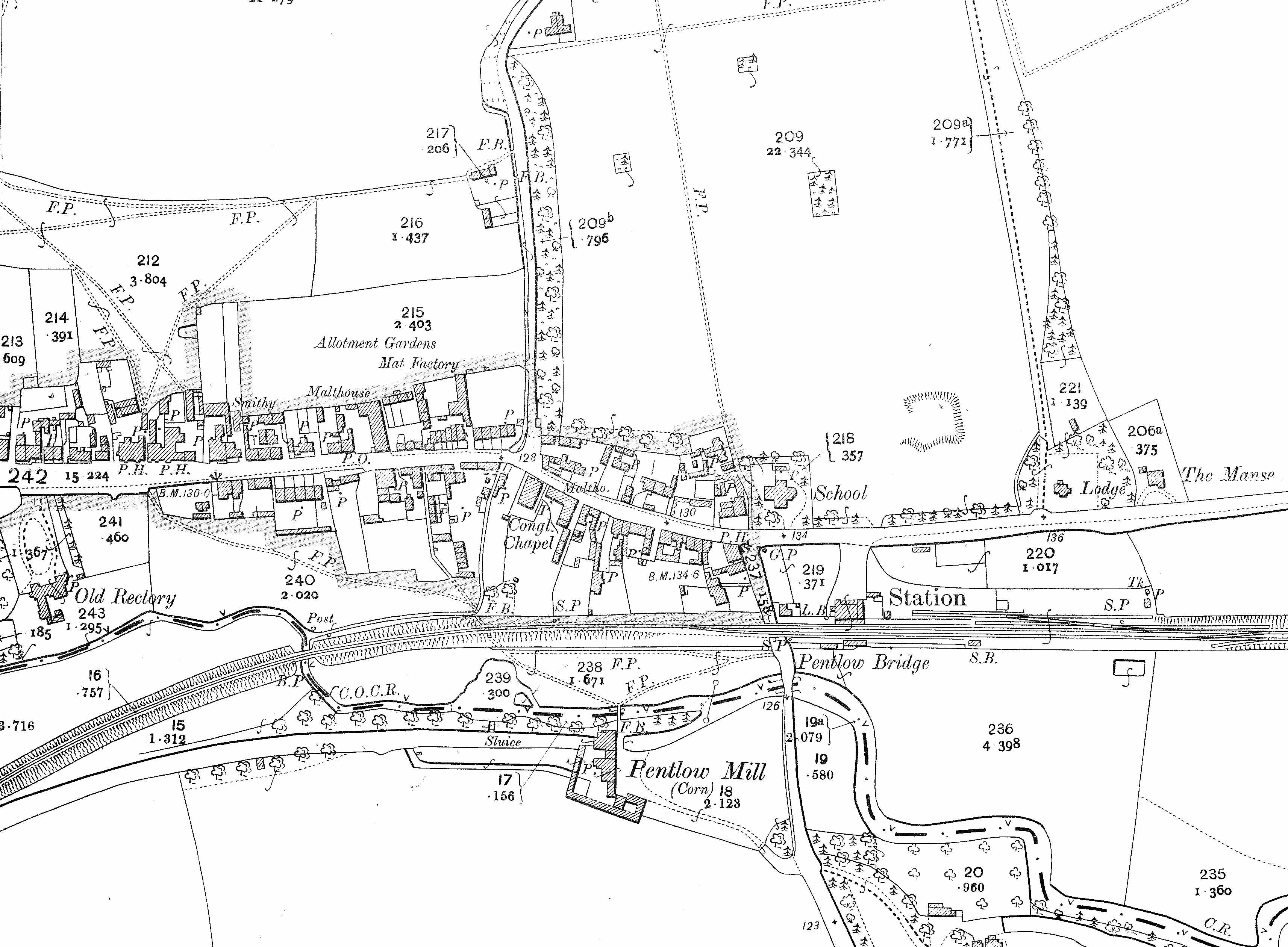
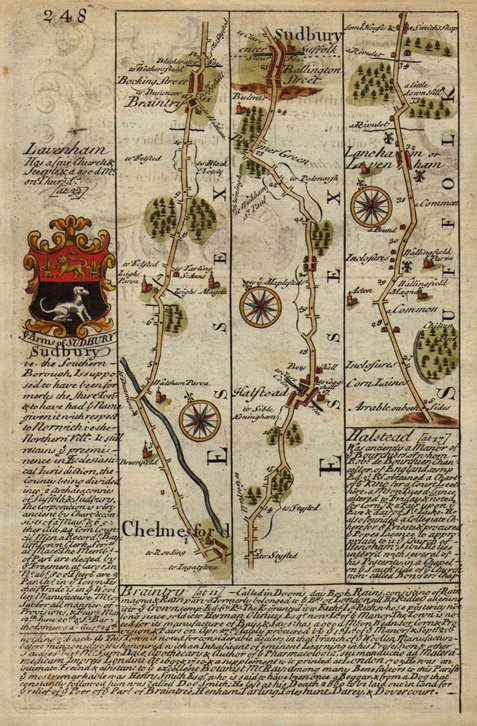
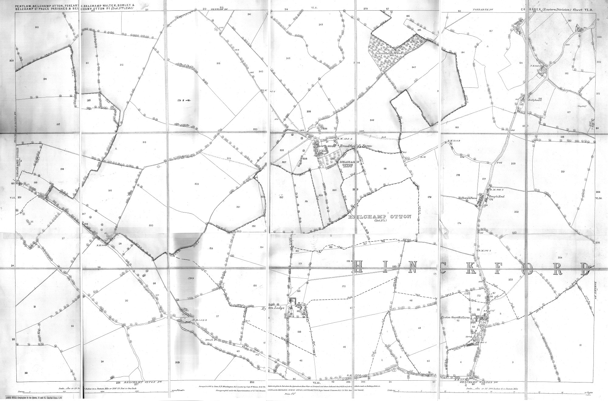
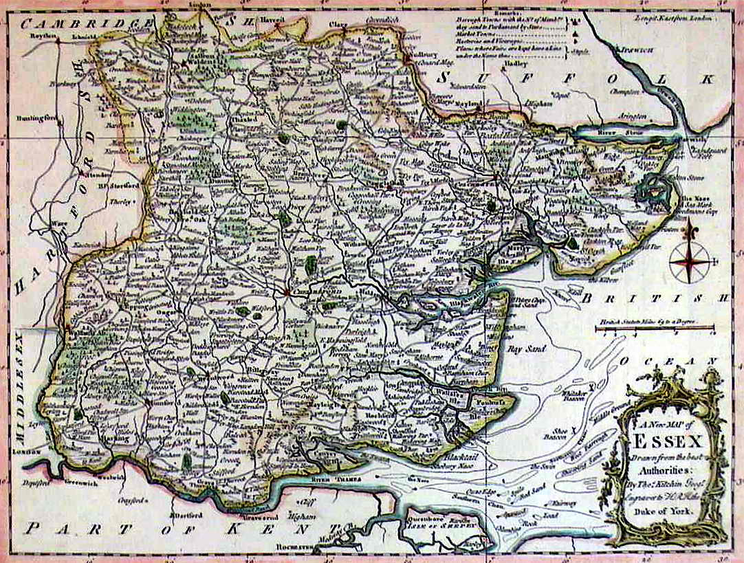
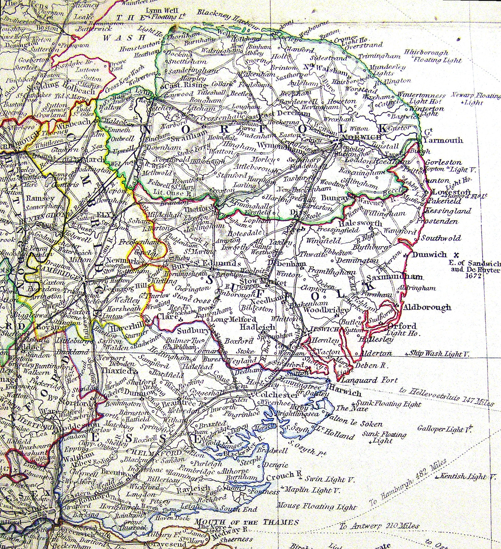
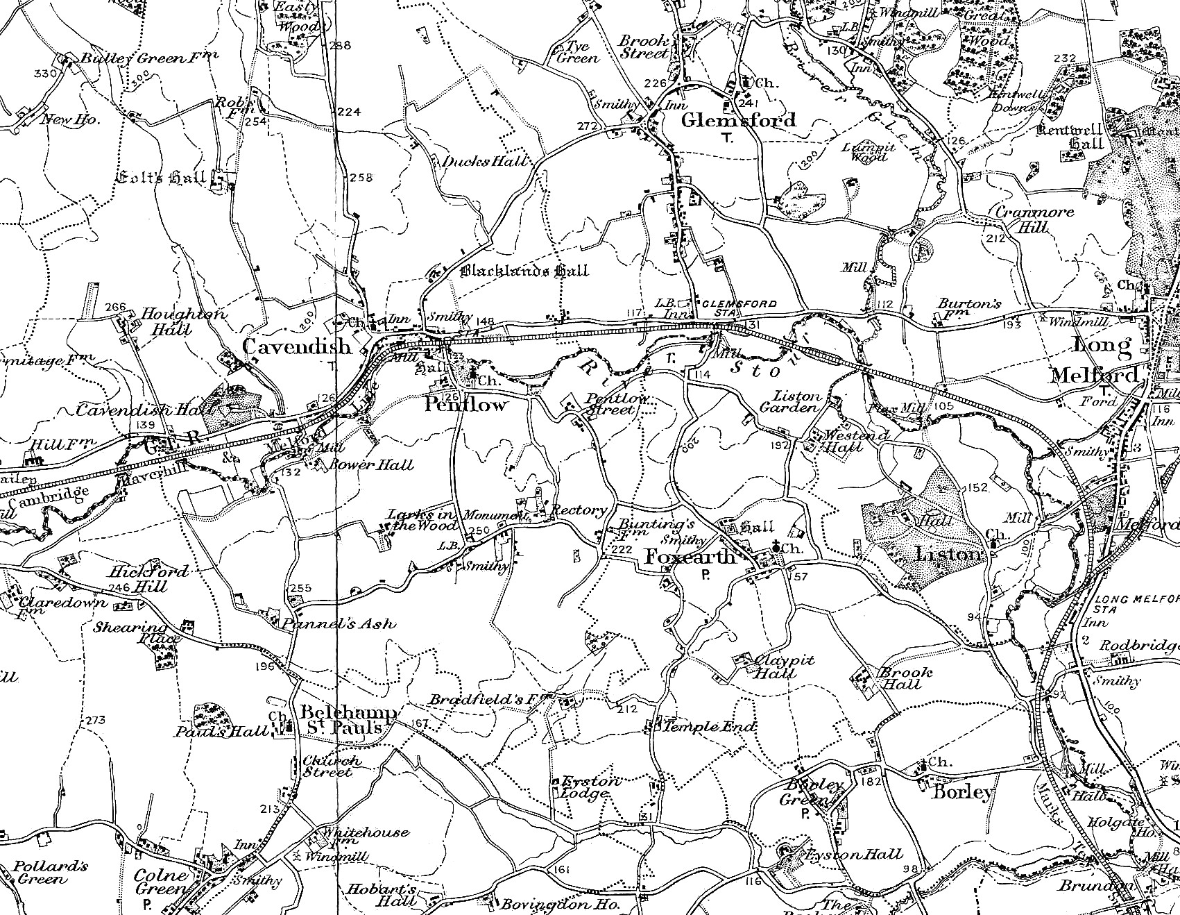
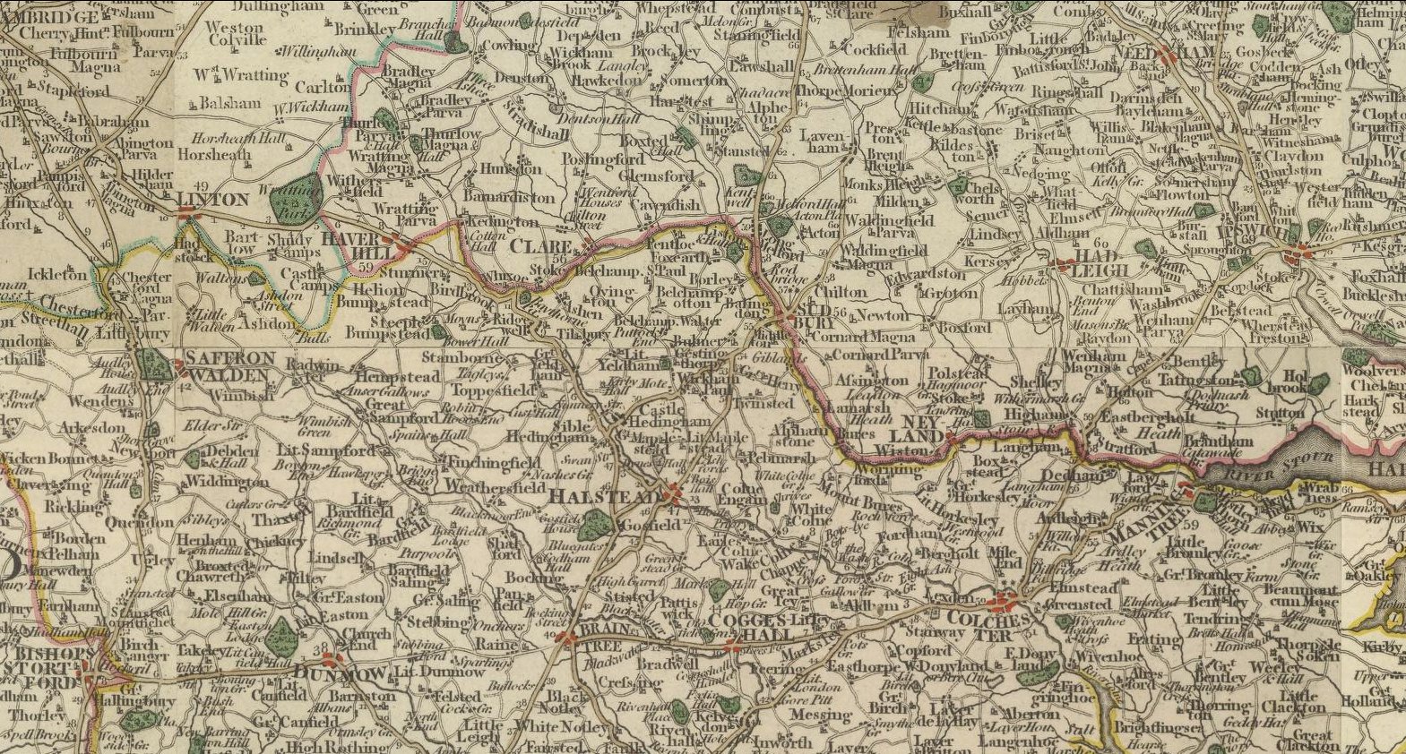
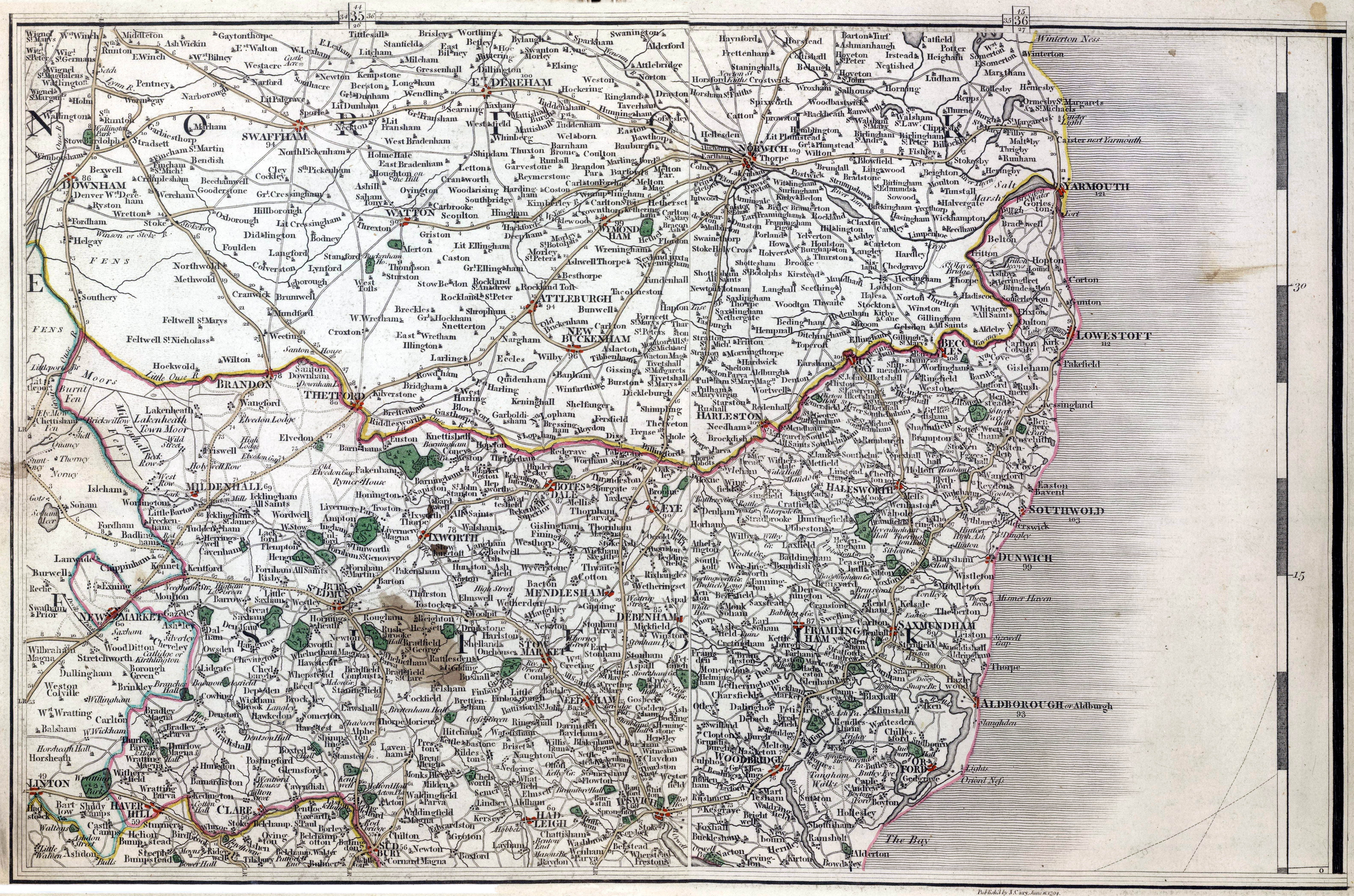
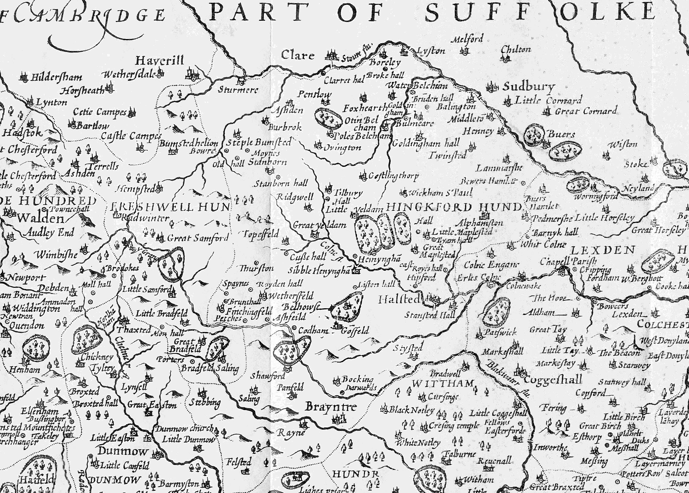
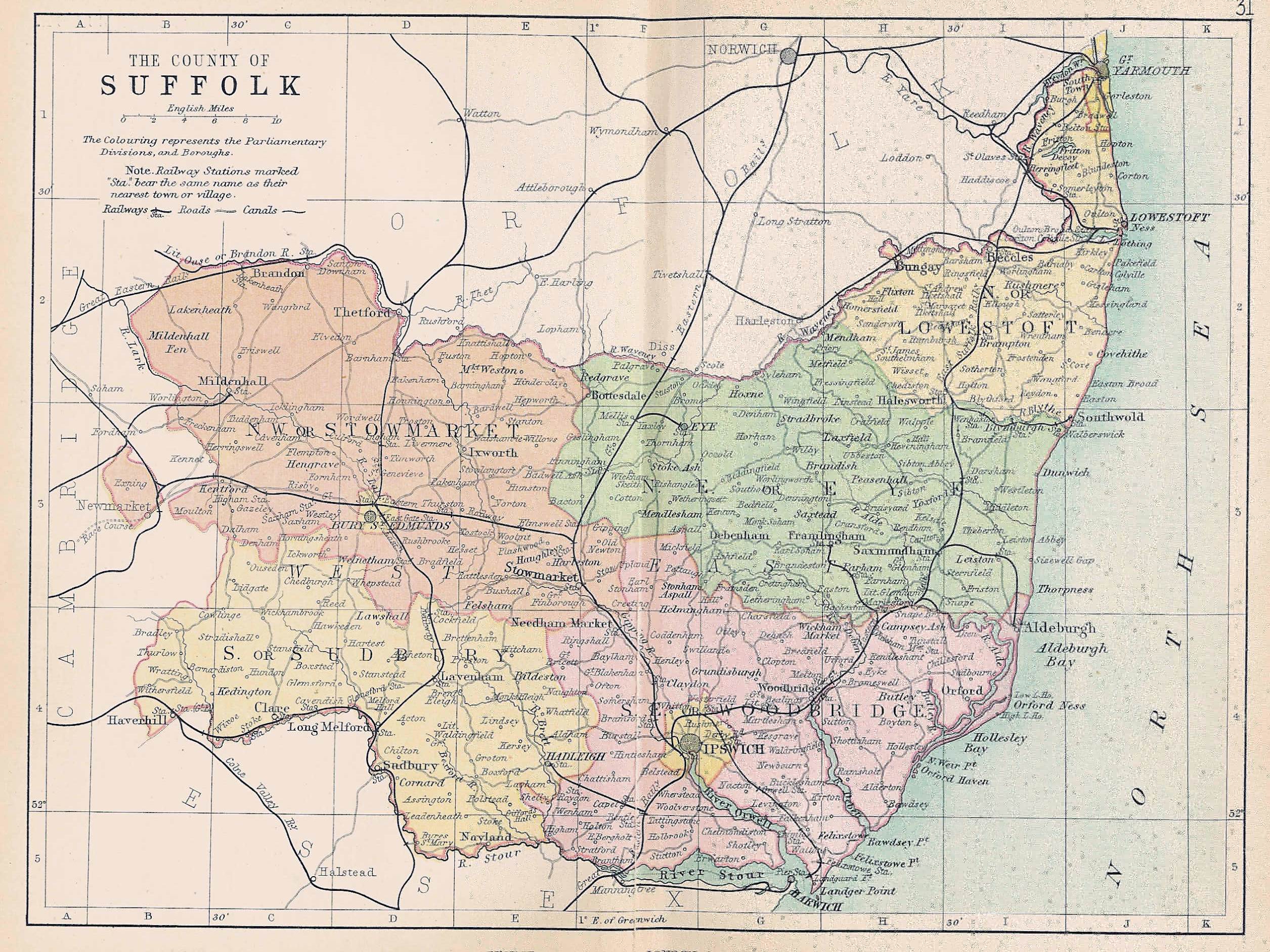
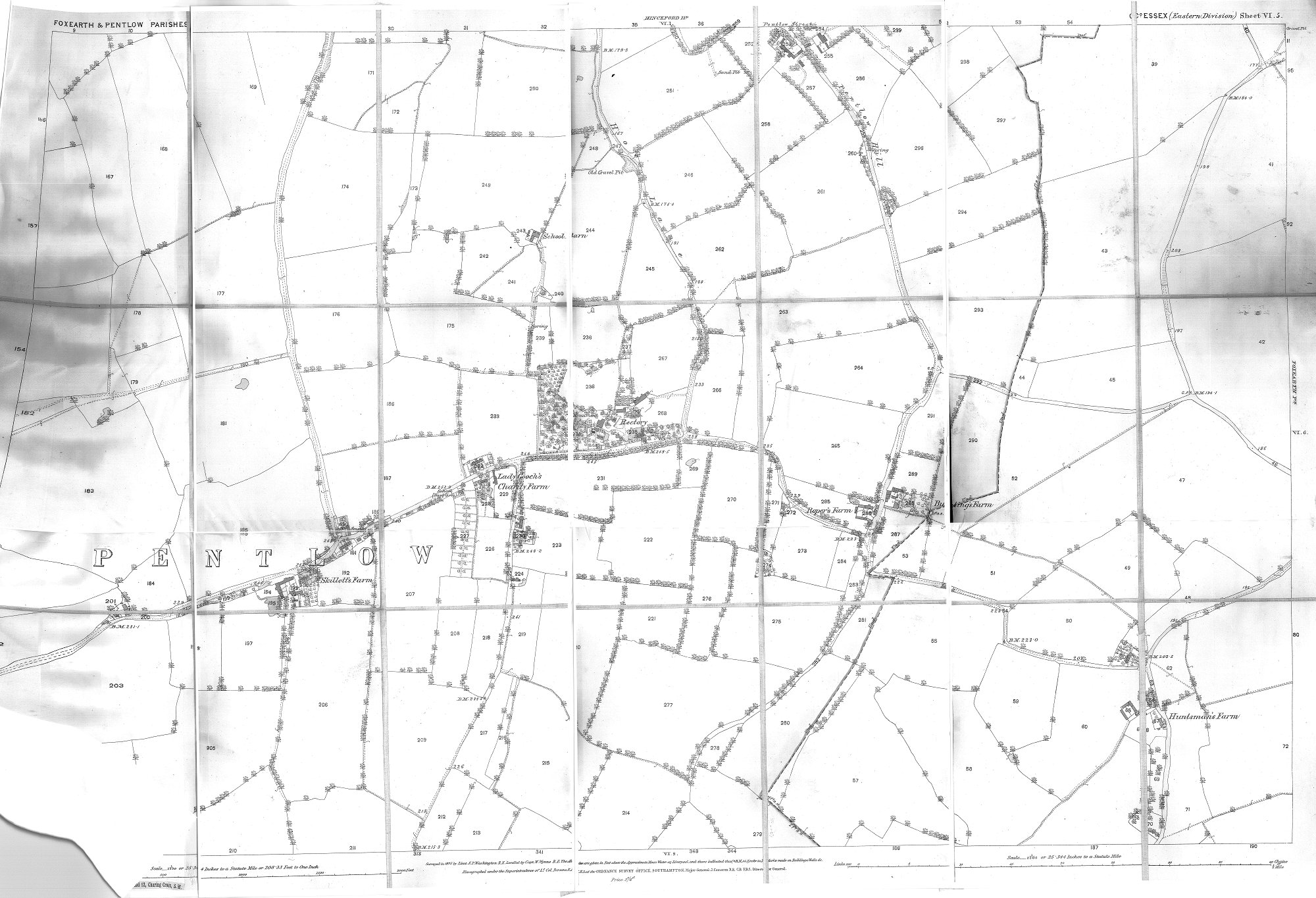
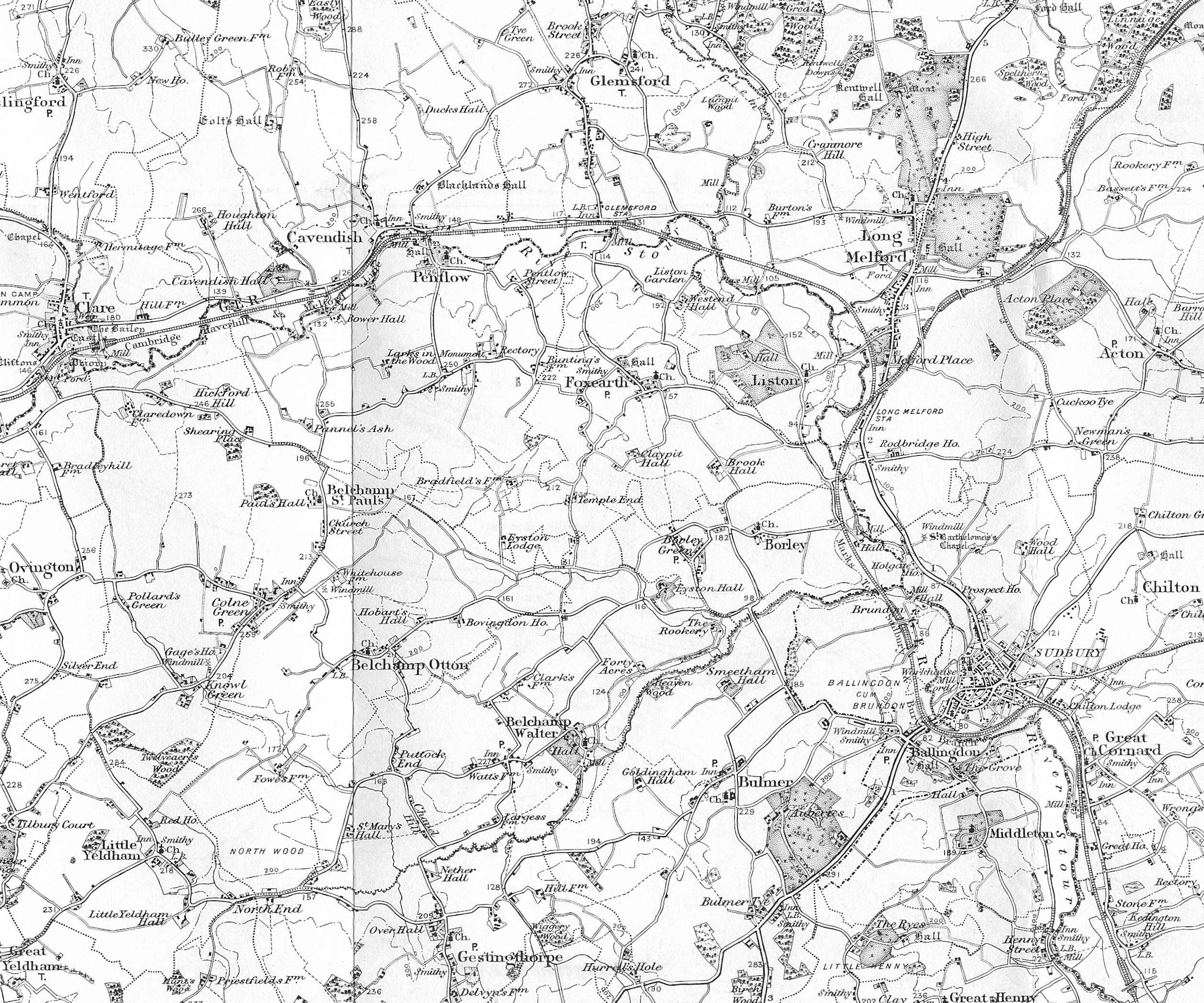
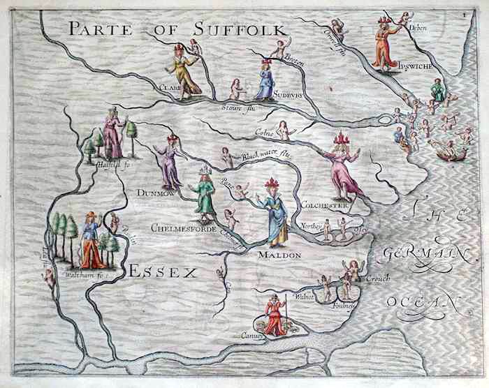
Thumbnails are quite large. click on them to see them full-size. Some of these maps are necessarily quite large. If you have a slow internet connection, you may have to wait for a spell, whilst the image downloads. High res versions of some of the maps are provided at the end, for serious study!

1824 map of the Pentlow Hall estate, showing the Hall Farm and the mill
Van Den Keere's 1603 map of Suffolk
Map of Suffolk by Spede
Saxton first Printed Essex Map (1575)
Saxton first Printed Suffolk Map (1575)
Robert Dawson's map of Sudbury (1831)
Richard Blome's Mapp of Y County of Essex (1673)
Detail of Foxearth from Chapman and Andre's map of Essex
1876 Ordinance Survey Map of Houghton Hall and Cavendish
The Hinkford Hundred, on Chapman and Andre's 1780 map
Essex on Gough's map of Get Britain 1360
First OS Map of Essex, 1804,
Detail of First OS Map of Essex, 1804, showing the four parishes
Map of Essex, by Van Den Keere 1603
1910 map of Essex
A map of Chelmsford, 1591
Detail of OS survey map of 1904, showing Cavendish
Bowen and Owen's itinerary of Chelmsford to Cavendish (c1720)
1876 Ordinance Survey Map of Belchamp Otten
Charles Verron's map of 1801 showing Glemsford, Sudbury and Bulmer
Thomas Kitchin's Map of Essex (1770)
Map of East Anglia, 1840, showing errors in where the railways went beyond Colchester
1898 OS map of the four parishes
Cary's map of 1794, a detail of the Sudbury area
William Morgan's 'Essex Actually Surveyed' (1678)
Map of Suffolk (1794)
A map of Essex by Spede
Philips Map of Suffolk (1895)
1876 Ordinance Survey Map of Pentlow
OS map of Pentlow, Liston, Foxearth and Borley, 1898
Olde Map of Essex
Kitchin's Map of Essex (1751)
Jan Janssonius 'Description of Suffolk' (1646)
Jan Janssonius 'Description of Essex' (1646)
Gough's 1360 map of Gt Britain
First OS Map of Essex, 1804 of Essex, detail of Sudbury to Gt Maplestead
Carey's Map of Essex, 1794
Emanuel Bowen's 1763 Map of Essex
1876 Ordinance Survey Map of Cavendish
Bowen's map of Essex (1720)
Detail of Robert Dawson's map of Sudbury, showing Borley
1876 Ordinance Survey Map of Belchamp St Pauls
Detail of Hodskinson's map of Suffolk (1783) showing Sudbury
Detail of Hodskinson's map of Suffolk (1783) , showing Clare
1758 map of the counties of England (T Kitchin?)
1745 map of Essex oriented west-east
1641 Map of Essex
map of the four parishes, taken from A New and Correct Mapp of Middlesex, Essex and Hertfordshire

Supplementary High-res versions

These need a good internet speed

1824 map of the Pentlow Hall estate, showing the Hall Farm and the mill
1876 Ordinance Survey Map of Houghton Hall and Cavendish
1876 Ordinance Survey Map of Belchamp Otten
1876 Ordinance Survey Map of Pentlow
1876 Ordinance Survey Map of Cavendish
1876 Ordinance Survey Map of Belchamp St Pauls